Some posts on this site contain affiliate links. If you book or buy something through these links, I earn a small commission (at no extra cost to you). Take a look at my privacy policy for more information.
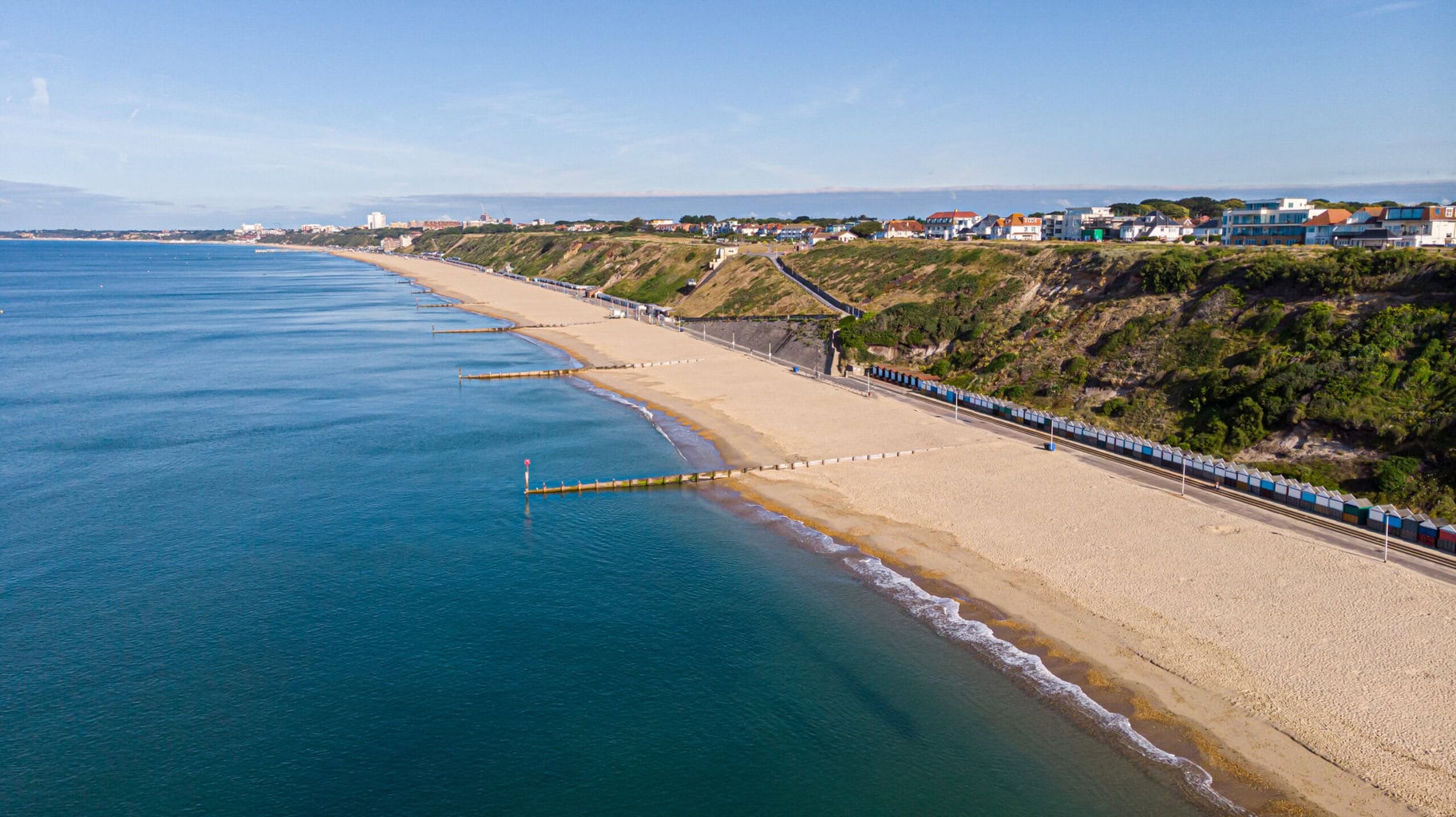
This Hengistbury Head walk is one of my favourite coast walks in Dorset. It’s a lovely, short circular which takes you up and over the 36m cliffs of the headland and down to the white sand beach of Mudeford Sandbank, before looping back across the saltmarshes that skirt Christchurch Harbour.
Hengistbury Head is a towering headland of golden sandstone, enclosing the natural harbour where the estuaries of the Stour and Avon rivers converge. For such a short walk, this route encompasses a surprising range of landscapes and environments.
Beaches, heathland, marshes, reedbeds, and woodlands can all be found on this 3.7-mile circular. Not to mention some stunning clifftop views, with an incredible 360-degree panorama from the highest point of the Headland.
Hengistbury Head Walk – Details and Map
- Distance: 6km / 3.7 miles
- Time: 1.5 – 2 hours
- Elevation Gain: 134m
- Difficulty: Easy
- Accessibility: Fairly accessible. There are no stiles on the route, and it mainly follows a tarmac path. There are some steps which can be avoided if you do not climb all the way up Hengistbury Head. My route also includes a walk along a section of sandy beach and some muddy “off-road” paths, both of which can be skipped if required.
- Parking: Paid parking at Hengistbury Head carpark (BH6 4EL – click here for exact location) – £4.40 for 2 hours during summer. You may be able to find road parking along Rolls Drive or the sidestreets in nearby Southbourne.
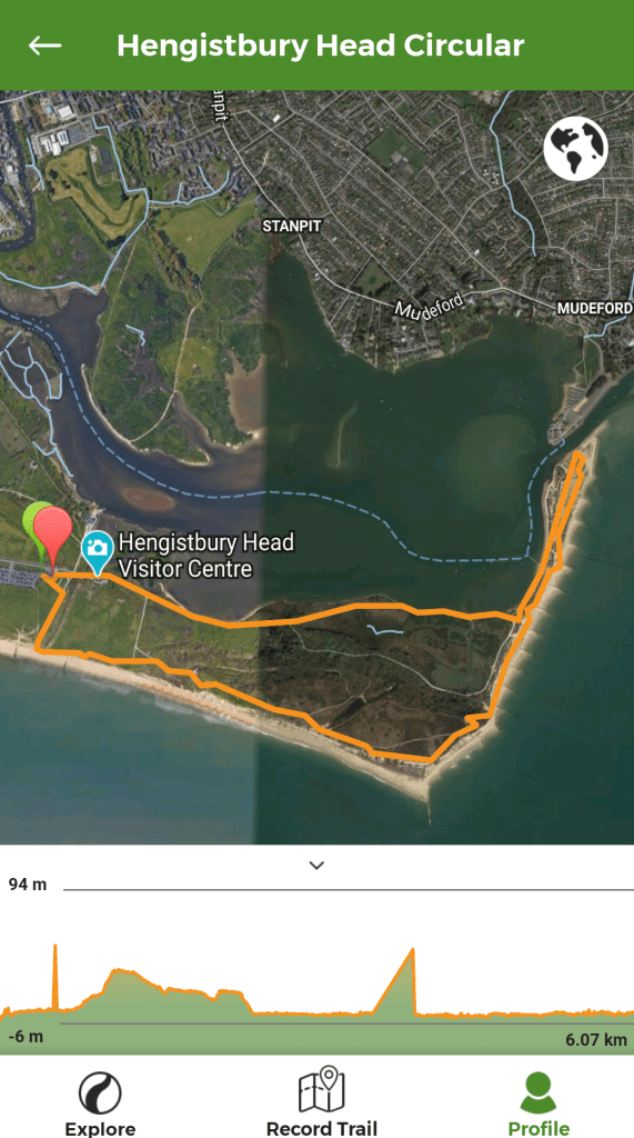
To make following this walk easier, feel free to use my GPS trail route on Wikiloc. It’s a free app where people can share hiking routes! You’ll probably still find my instructions below helpful, though.
Optional Extension
If you want a longer walk you can park near Southbourne Beach (click here for the location) and walk along the beach in order to reach the start point of this walk: the cafe in Hengistbury Head car park.
Alternatively, you could start from Boscombe Pier and walk all the way along the seafront to reach the start point. This adds an additional 3.3 miles (roughly 1 hour) each way.
If you’re starting in Bournemouth town centre, you can take the Land Train along the seafront as far as Boscombe in order to start the longer version of this Hengistbury Head walk.
Stour Valley Way
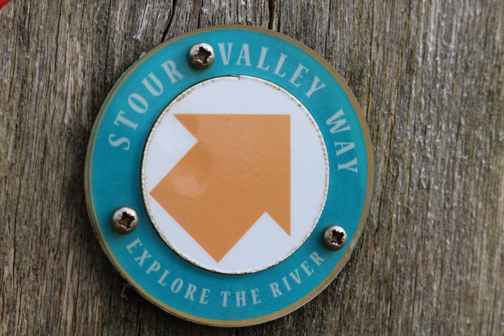
The Hengistbury Head circular walk follows the Stour Valley Way, a long-distance walking route that starts at the source of the River Stour in Wiltshire and runs all the way down through Dorset to meet the sea at Christchurch Harbour. The whole route is well-signposted with the Stour Valley Way arrow markers, a teal circle with an orange arrow at the centre.
Hengistbury Head 3.7 Mile Circular Walk
Step One – to Hengistbury Head Beach
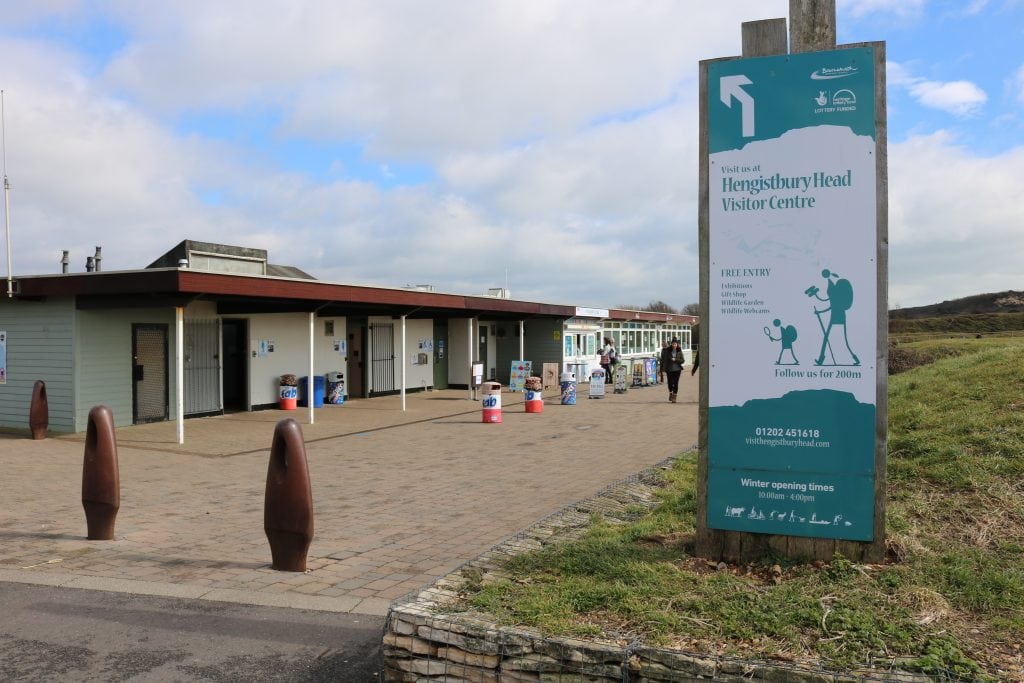
Start at the Hiker Cafe at the far end of Hengistbury Head car park. There are toilets and refreshments here, as well as a small play park and several picnic benches.
If you want, you can make a detour to the Hengistbury Head Visitor Centre before starting your walk. However, you will pass the Centre on the return journey and can call in then.
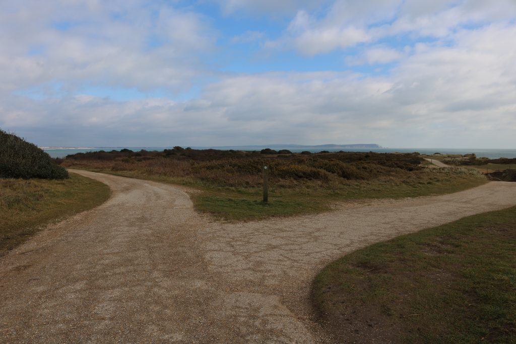
From the cafe, bear right slightly towards a path along a wooden fence. This fence marks the boundary of the Double Dykes, an iron age hill fortification built to protect the landward side of the headland. You can view the Dykes through the fence, but they are off-limits to walkers in order to preserve the barrows.
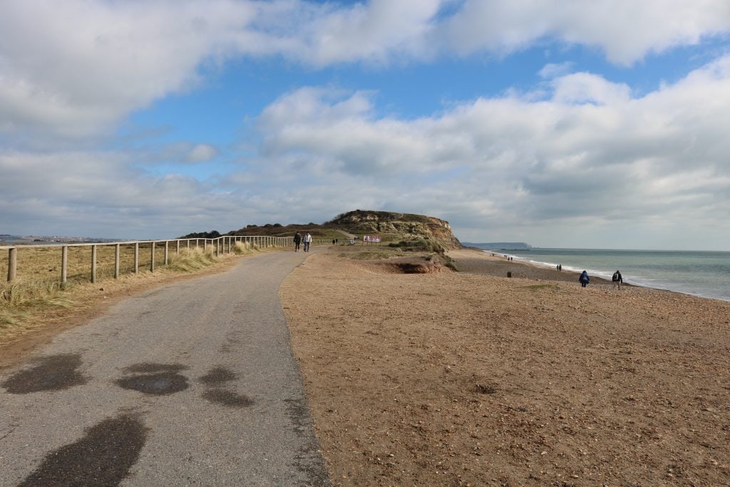
Turn right at the fence and follow the path up towards the sea. Looking back across the beach, you can see all the way along the promenade to Bournemouth and across the bay to the Isle of Purbeck on the other side.
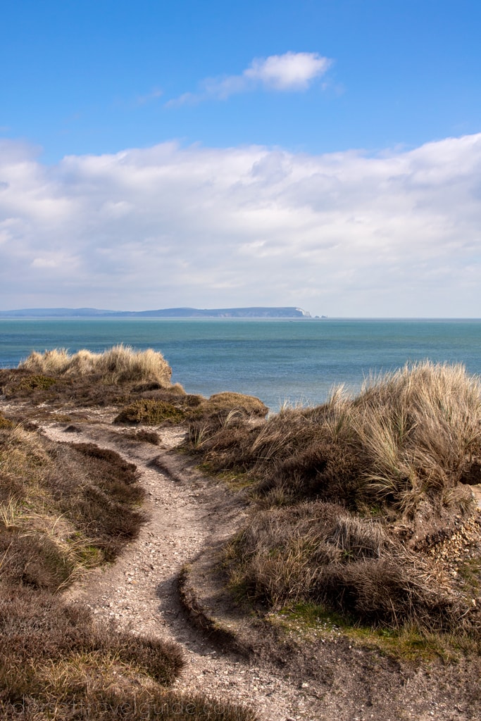
Turn left and follow the marked path along the edge of the beach until it veers slightly left and uphill. As you begin to climb, look back over your left shoulder for a view across the marshes to Christchurch.
Step Two – Climb Hengistbury Head
Shortly, you will reach a fenced-off area on your right with a small pond. This little area is home to an abundance of local wildlife, including rare Natterjack Toads.
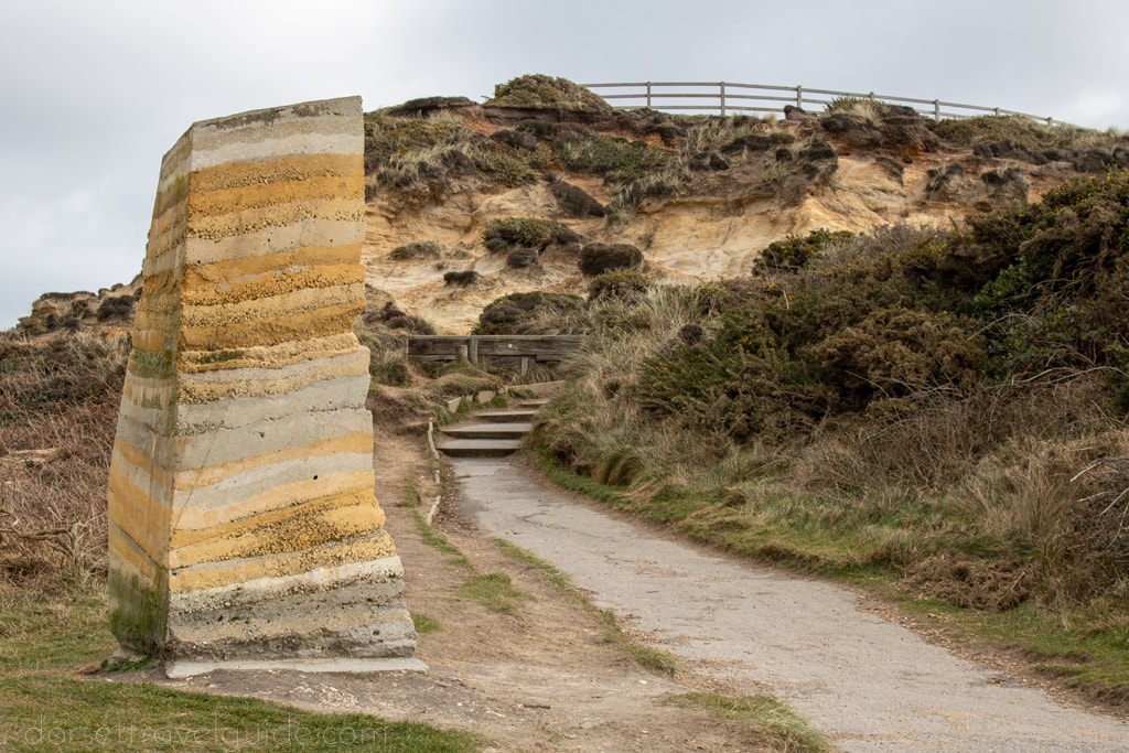
Stay on the tarmac path following the Stour Valley Way arrow markers. You’ll pass a unique sandstone sculpture by local artist Briony Marshall, after which* the path curves steeply round to the right – with fab views of the sea below and Bournemouth behind you – before opening out at the top of the headland.
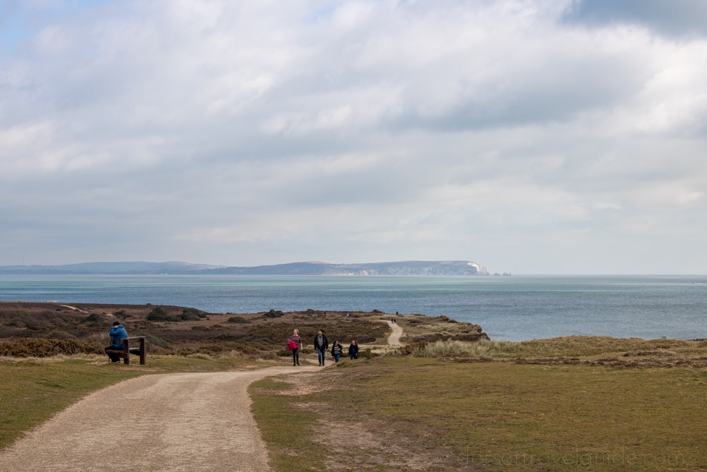
From the top here you can enjoy an incredible 360-degree panorama, with Mudeford and Christchurch on the left and Mudeford Spit cutting across the harbour below. Directly ahead, you can see The Needles on the Isle of Wight, which line up with their brothers at Old Harry Rocks in the west – also visible behind you.
*There are a couple of steps here. For a step free walk you can detour left across the headland and down the other side, without going all the way up.
Step Three – Tip of the Headland
Continue following the path, past a Coastguard station on your right, as it slopes gently downhill with The Needles across the sea ahead of you.
When the path flattens out, you will come to a fork. For a shorter walk, take the left turn and follow that path diagonally across the headland to reach some steps down to the beach at Mudeford Sandbank.
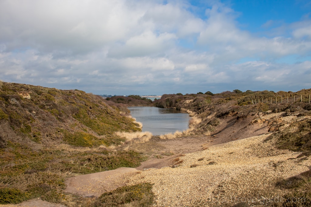
Otherwise, follow the Stour Valley Way marker down the right-hand fork and continue following the path past Quarry Pond on your left – stopping here to enjoy the view and spot any local wildlife – and out to the very tip of the headland.
Stay on the tarmac path unless you want to explore the heathlands around the top of the Headland.
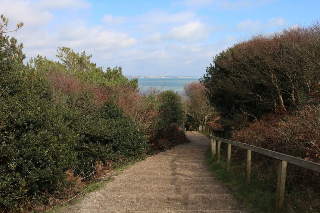
Eventually, the path will reach a viewing area with a couple of carved stone benches. Not only is this an amazing view of The Needles on the Isle of Wight, but it also provides an excellent view from above of Mudeford Sandbank and across the harbour to Mudeford.
After stopping at the viewpoint, loop back to the path and head down some steps through the trees towards the beach.
Step Four – Mudeford Sandbank
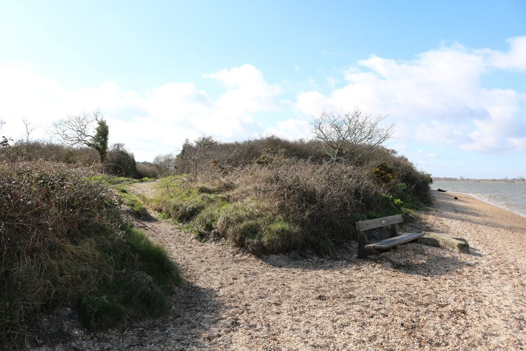
When you come out onto the sand, the main path back towards the Visitor Centre and carpark is on your left. But before heading back it’s a nice idea to walk all the way along both edges of the sandbank first.
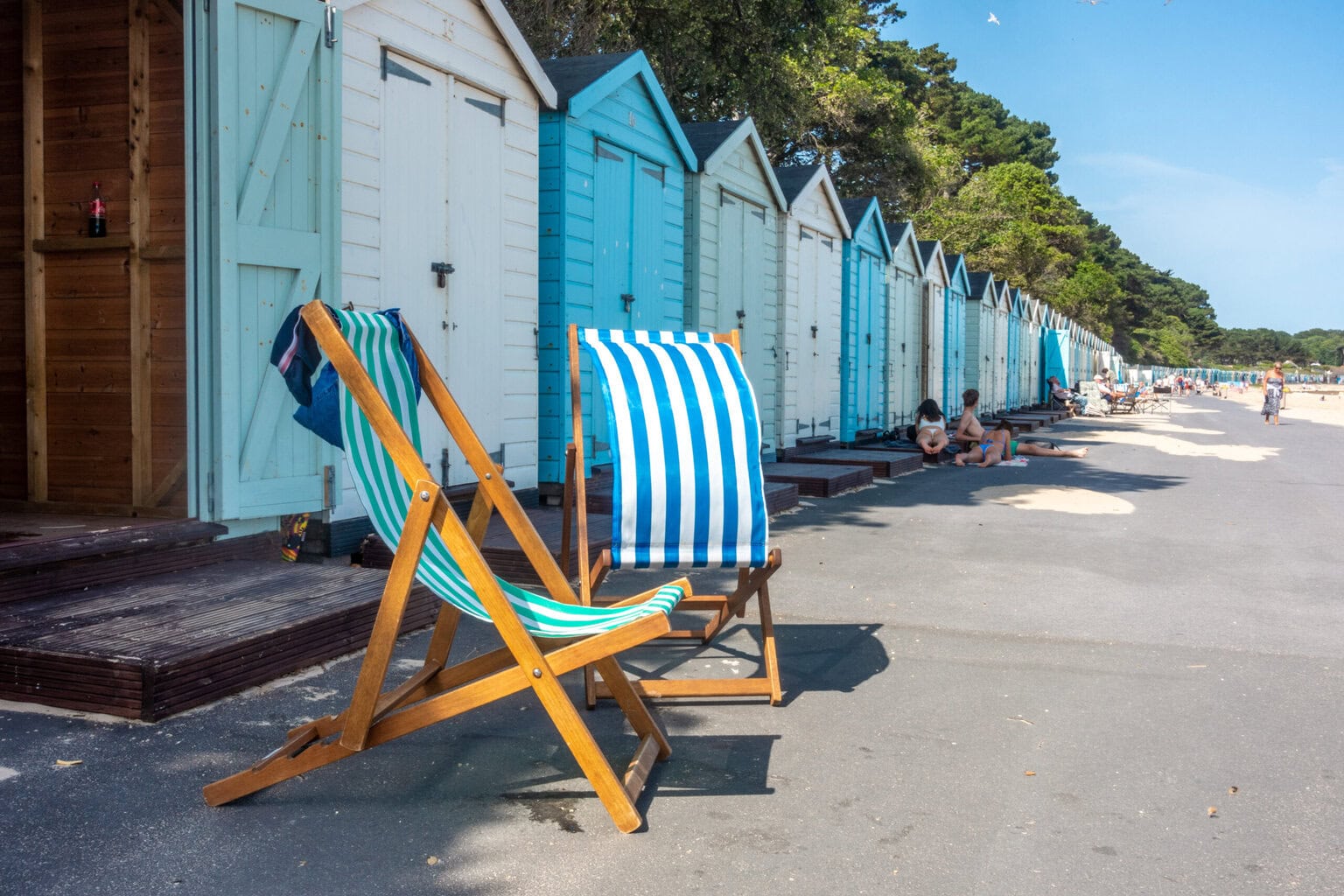
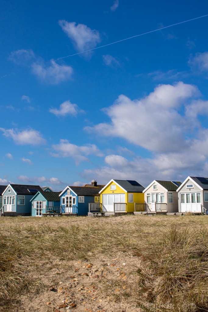
The brightly painted beach huts here are some of the most expensive in the country, selling for upwards of £300,000! With views across the sea to Isle of Wight on one side and over to Christchurch Harbour and marshes on the other, it’s easy to see why this is such a popular spot. The sandbank itself is one of the loveliest beaches in the area, lined with windswept sand dunes topped with long grasses.
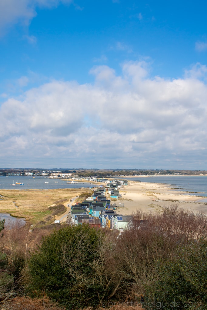
Walk all the way along the Eastern side of the spit, eventually joining a gravel path that leads all the way to the tip, then loop around and head back along the other side with the harbour on your right.
There is a toilet block on the beach, and about halfway along the sandbank is a small cafe So there are plenty of facilities if you want to stay a while and enjoy the views – or take a dip if the sea is calm!
Optional extension: If the ferry services are running you can extend this walk by taking a ferry across the narrow section of water that divides Mudeford Sandbank from the mainland, and continue walking along the coast at Mudeford to reach Highcliffe Castle.
Step Five – Marshes and Christchurch Harbour
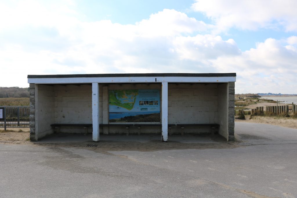
At the end of the beach path, just after the beach curves naturally to the right with Hengistbury Head before you, you’ll see a small stone hut with a map and information board about the Stour Valley Way.
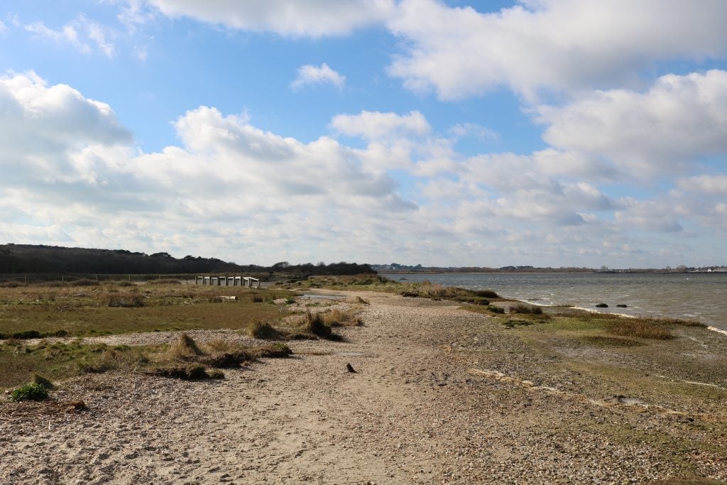
From here you have two options: the tarmac path which runs back along the bottom of Hengistbury Head, or a more scenic route through the marshes. The second option involves walking on shingle beach and uneven dirt tracks which can be quite muddy.
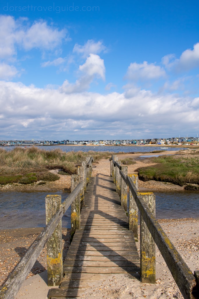
For the scenic route, turn right just before the stone hut. Follow a dirt path along the edge of the beach as it curves around Christchurch Harbour. Shortly, a narrow wooden bridge will lead across a small river. Turn around here for an excellent view! After the bridge, the path will skirt along the edge of the marshland on your left.
Accessible Route: If you prefer to stick to a tarmac path, you can instead follow the main path forward past the hut. It will curve right and follow the foot of Hengistbury Head into woodland.
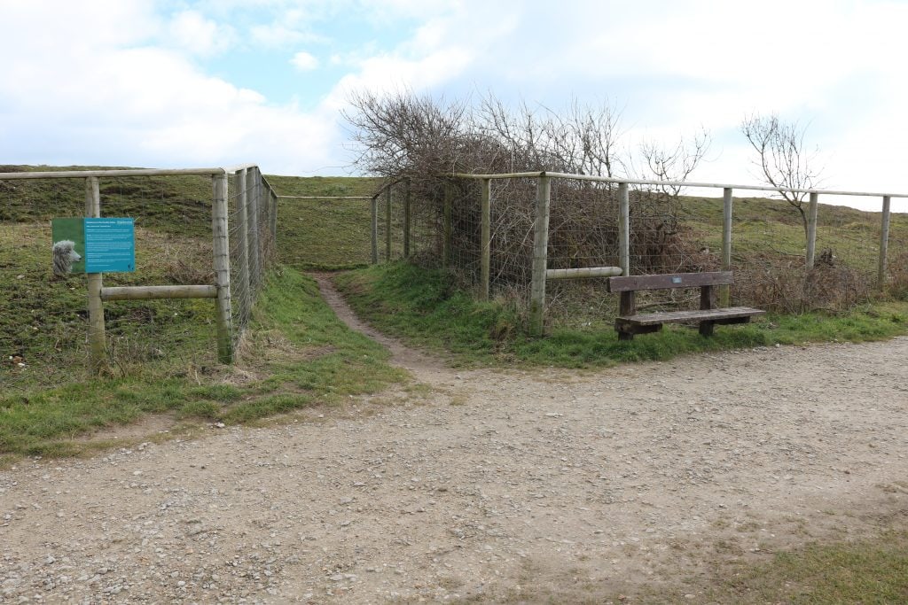
If following the “off road” path, continue walking along the beach past two benches. At the second bench, fork left up a dirt track that leads through bushes towards a wooden gate.
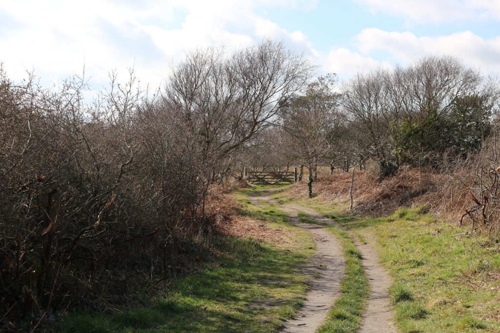
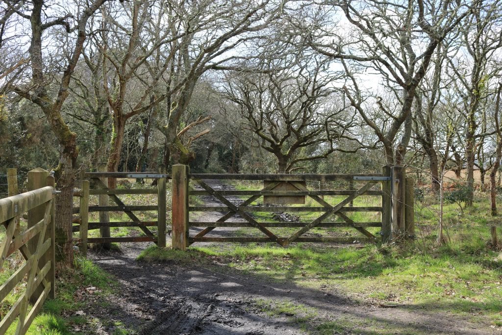
Pass through this and keep following the path, with the fenced-off marshes on your left and another fence on your right. The path here can be pretty muddy in wet weather. Keep an eye out for local birdlife including snipe, redshank, godwits, and little egrets. The reedbeds are also home to kingfishers and marsh harriers.
Step Six – Back to the Carpark
At the edge of the small woodland ahead, you will come to another wooden gate with a kissing gate. Pass through this and a short way ahead you will rejoin the main tarmac path.
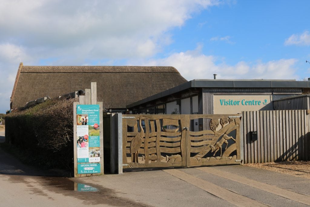
Turn right and continue along the tree-lined path until you reach the Visitor Centre.
It’s housed in a thatched-roof building and contains a wealth of information about the local area and wildlife, as well as a few live exhibits, so it’s well worth a visit. Plus, the gift shop here is absolutely lovely.
If you wish to extend your Hengistbury Head walk, you can curve right at the visitor centre and complete a loop around the Wick Meads nature reserve.
Otherwise, follow the path on past the visitor centre and back to the cafe which is just up ahead.
I hope you enjoy my walk around Hengistbury Head and Mudeford Sandbank! If you have any questions, feel free to leave a comment below or get in touch!
Read More
31 Things to do in Bournemouth