
Some posts on this site contain affiliate links. If you book or buy something through these links, I earn a small commission (at no extra cost to you). Take a look at my privacy policy for more information.
This circular walk from Studland to Old Harry Rocks and into the chalk grasslands of Ballard Down is one of the loveliest on the Isle of Purbeck.
It’s an easy-to-follow 4-mile route looping around the headland which marks the eastern end of the world-famous Jurassic Coast, then climbing up the ridge of Ballard Down for some exceptional views of Swanage Bay on one side, and Studland, Sandbanks and Poole Harbour on the other.
In spring and summer, the grasslands are carpeted with colourful wildflowers, and the beautiful South Beach in Studland provides a sheltered spot for a cooling swim at the end of your walk. But this route is stunning at any time of the year!
Although a popular walking route, it’s not signposted and might be tricky for newcomers to follow. So this local’s guide should help you find your way! Grab your suncream, pack your camera, and get ready for some seriously amazing views…
Old Harry Rocks Walk – Details And Map
- Distance: 6.5km / 4 miles
- Time: 1.5 – 2 hours
- Elevation Gain: 201m
- Difficulty: Easy-Moderate
- Accessibility: No styles, one kissing gate (avoidable if necessary). Varied terrain types, including uneven dirt and loose-stone paths, and grass tracks. Moderate incline most of the way followed by a steeper descent. Some of the walk follows country roads with no pavement.
- Parking: Paid parking at South Beach Carpark in Studland (BH19 3AU) – free for National Trust members or £5 for 4 hours (£7 all day). There is little road parking nearby so the car park is your best bet.
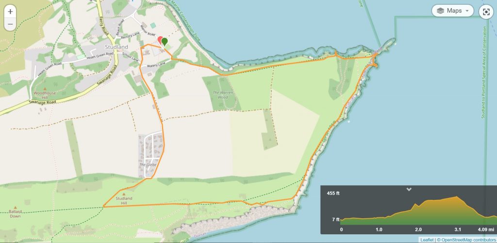
To make following this walk easier, feel free to use my GPS trail route on Wikiloc. It’s a free app where people can share hiking routes! You’ll probably still find my instructions below helpful, though.
Old Harry Rocks Circular Walk Route
Step 1 – Car Park to Old Harry Rocks (25 minutes)
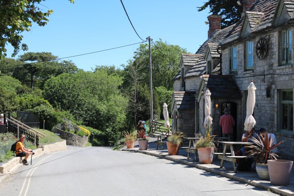
Walk out of the car park and turn right. Follow the road down hill past the Bankes Arms pub. At the bottom of the hill, you will see a path on the left leading to the beach, followed by a small white brick building containing public toilets.
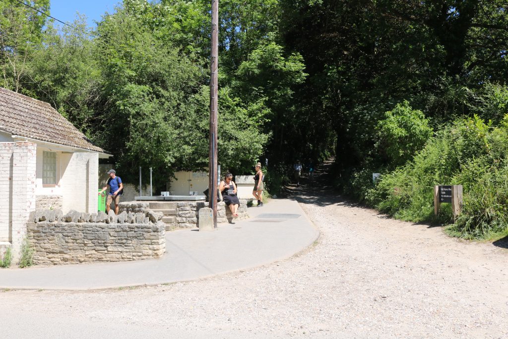
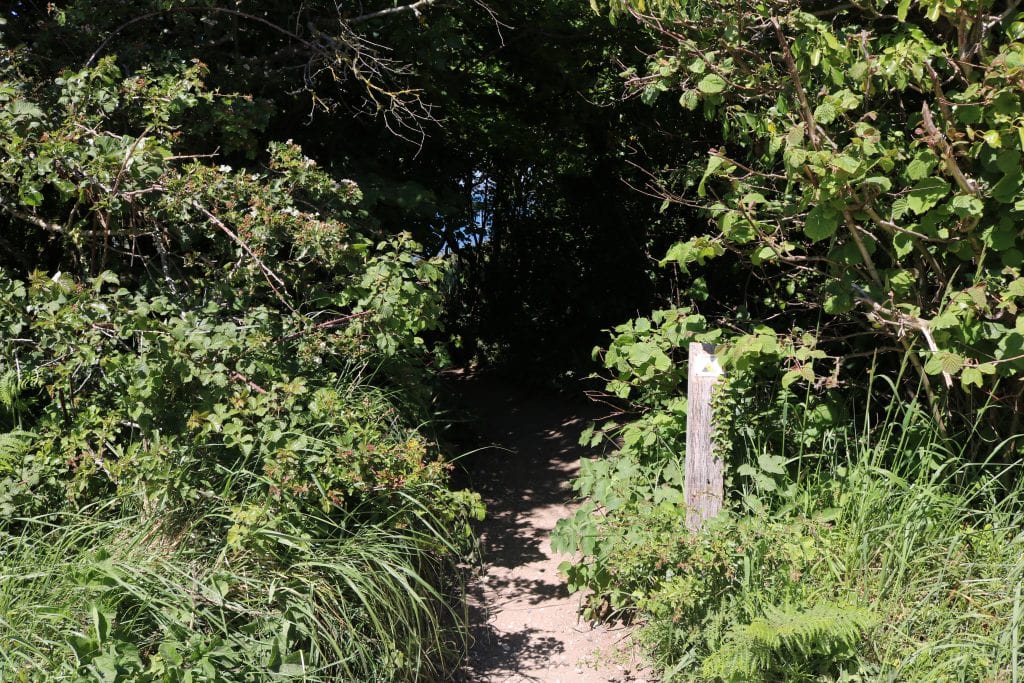
Next to the toilets is a gravel and stone track signposted for Old Harry Rocks. Turn left to follow this track uphill in the shade of tunnelling trees. The walk to Old Harry Rocks is one mile and takes around 20 minutes. Simply keep following the path.
As you climb out of the trees, enjoy incredible views across Poole Harbour towards Bournemouth on your left.
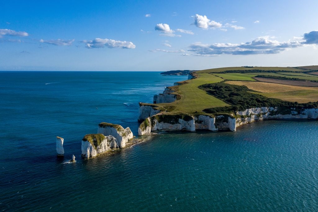
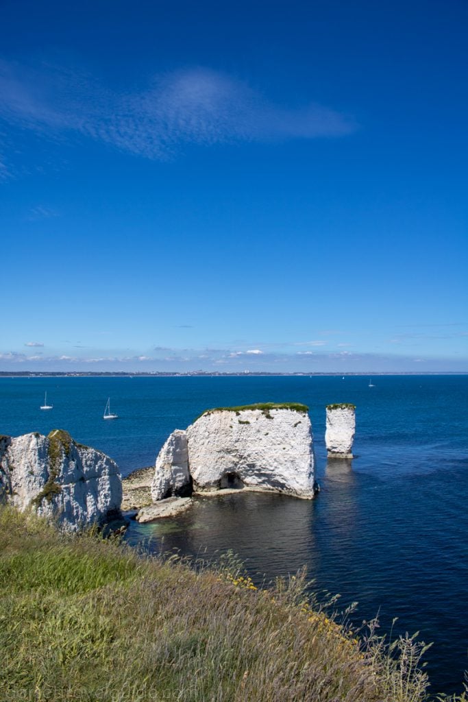
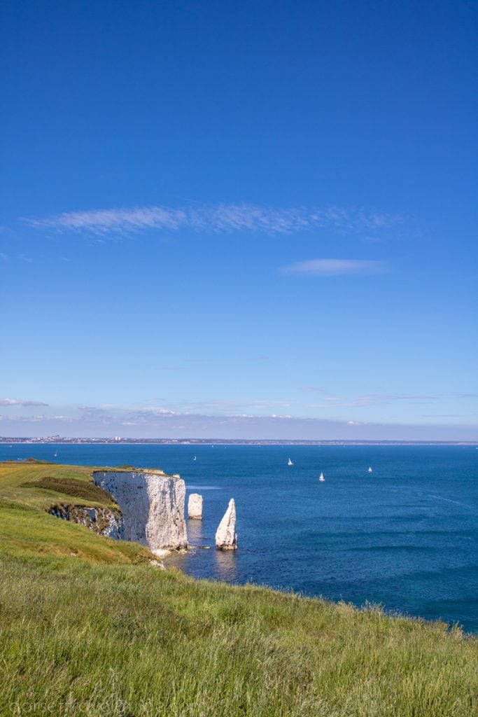
After about 20 minutes, the path opens out onto a grassy headland with Old Harry Rocks in front of you. Spend some time here walking around the cliffs and admiring the rock stacks from different angles. Standing in front of the Rocks and looking straight across the water, you can see the Isle of Wight.
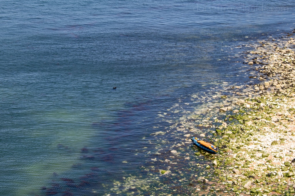
Keep an eye out for local bird and wildlife, last time I was there I saw a seal swimming just off the beach beneath Old Harry!
What Are Old Harry Rocks?
Old Harry Rocks mark the easternmost point of the Dorset Jurassic Coast. These are a group of chalk rock stacks stretching out into the sea from Handfast Point on the Isle of Purbeck. Local legend holds that the rocks are named after Harry Paye, a pirate from nearby Poole.
Once upon a time, Purbeck and the Isle of Wight were connected by a chalk ridge. Old Harry Rocks, and their counterpoint The Needles on the Isle of Wight, are remainders of this chalk ridge.
Step 2 – Rejoin the SW Coast Path (15 minutes)
Once you’re done with Old Harry, follow the grass track up the other side of the headland. Simply keep the sea on your left and climb uphill.
In summer, the chalk grassland on your right is covered with buttercups and yellow kidney vetch, making it especially pretty.
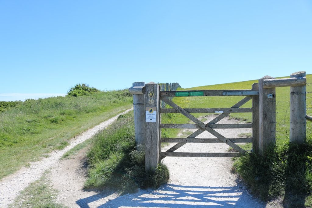
After about 15 mins you will come to a wooden gate. Turn around here for an exceptional view of the Pinnacle Stack. Walk carefully towards the cliff edge for an excellent view of the stacks, but don’t get too close!
Step 3 – Climb Ballard Cliff (12 minutes)
Don’t pass through the gate. Instead, take the path to its left and continue straight uphill with the fence on your right and the sea on your left, following the Dorset Council Public Footpath waymarker.
At Ballard Point, the coast path begins to curve to the right. Across the bay head of you is the quaint seaside town of Swanage. This spot marks the endpoint of the Purbeck Way, a 27 ¾ mile long-distance walking trail from Wareham to Ballard Down. Follow the stone marker for the Coast Path and keep on the gravel path as it climbs uphill over the back of Ballard Cliff.
Step 4 – Up Ballard Down (20 minutes)
After another 10 mins or so you will reach another wooden gate. Here, you can enjoy a splendid view of Swanage and the Bay. Head through the gate following the green Purbeck Way arrow marker.
Ahead of you is a short stone Monument at the entrance to Ballard Down. Head past this and follow the gravel, then grass, track straight forwards across Ballard Down. To your right are exceptional views of the beaches at Studland, with Sandbanks and Brownsea Island beyond.
Ballard Down is an area of chalk downland known for its summertime wildflowers, incredible views. It’s also home to three bronze-age earthworks.
Pass through a second wooden gate and continue heading straight uphill following the stone marker for The Obelisk, ignoring the coast path and the Purbeck Way which drift away to the left here.
Just through the gate are two round barrows highlighted by an arrangement of stones. These are burial barrows dating back to the Bronze Age. A reminder that you’re walking where our ancestors did thousands of years ago!
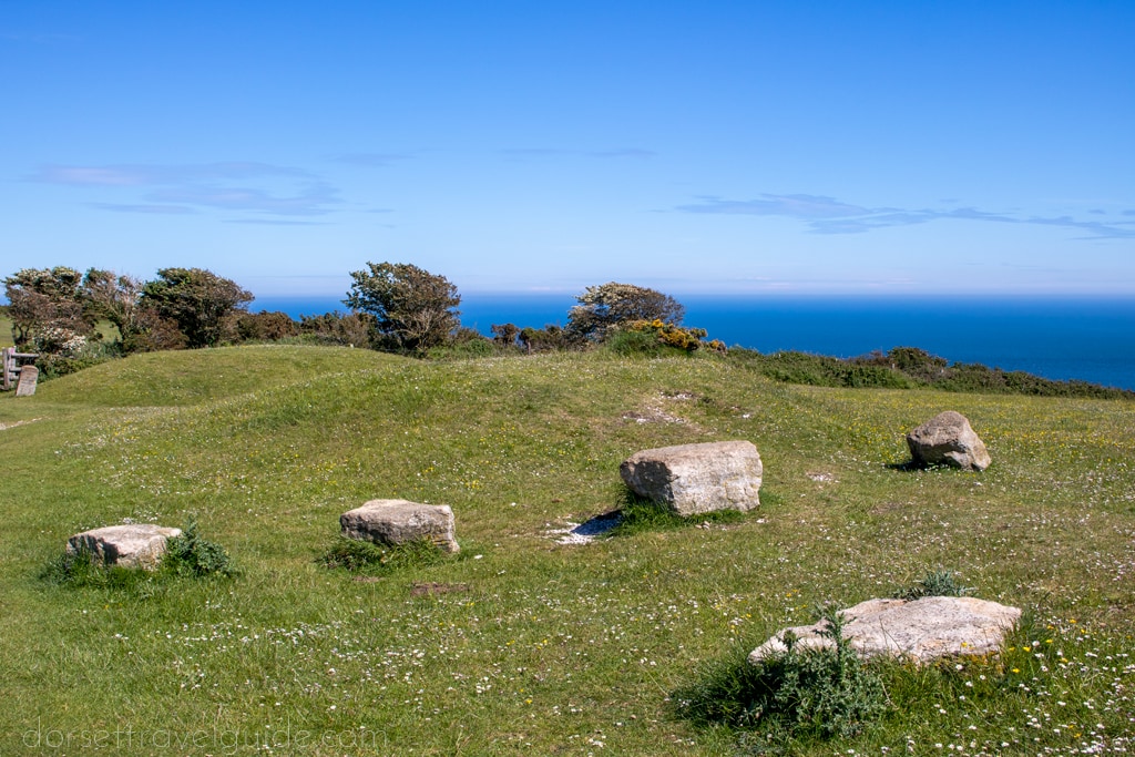
As you climb, you will pass a stone marker for Ulwell next to a very windswept tree on your right, then a small stone bench. I only mention these as “landmarks” so you know you’re still on the right track!
Step 5 – Down to Glebeland Estate (12 minutes)
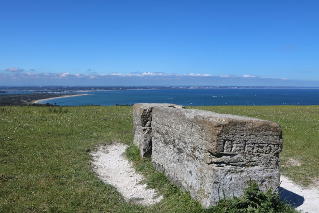
Shortly before you reach the top of the hill, you’ll come to a crossroads of grassy tracks, where you’ll find a very old stone bench. You can just about make out some of the letters from the etching which used to read “Rest and Be Thankful”. The only parts of the inscription still legible are the initials DJ and the date 1852 on one end of the bench.
Standing on the crossroads looking at this bench, turn right and follow the grass track downhill towards Studland. The path cuts diagonally downhill toward the small hamlet called Glebeland Estate.
Optional: If you wanted to extend your walk by another couple of miles, you can instead keep following the grassy track forward to The Obelisk – a small stone tower built in 1883 – and around to meet with the B3351 road, which you can follow back to Studland.
Step 6 – Back towards Studland (12 minutes)
Towards the foot of the hill, you’ll pass through another wooden gate, then the path becomes a road. Follow this road downhill past the Glebeland Estate with the sea ahead of you.
Interestingly, this hamlet was initially a WWII army camp. After the war, people bought the chalets as holiday homes, and the site evolved into a mini-estate. Today it’s home to some pretty stunning real estate.
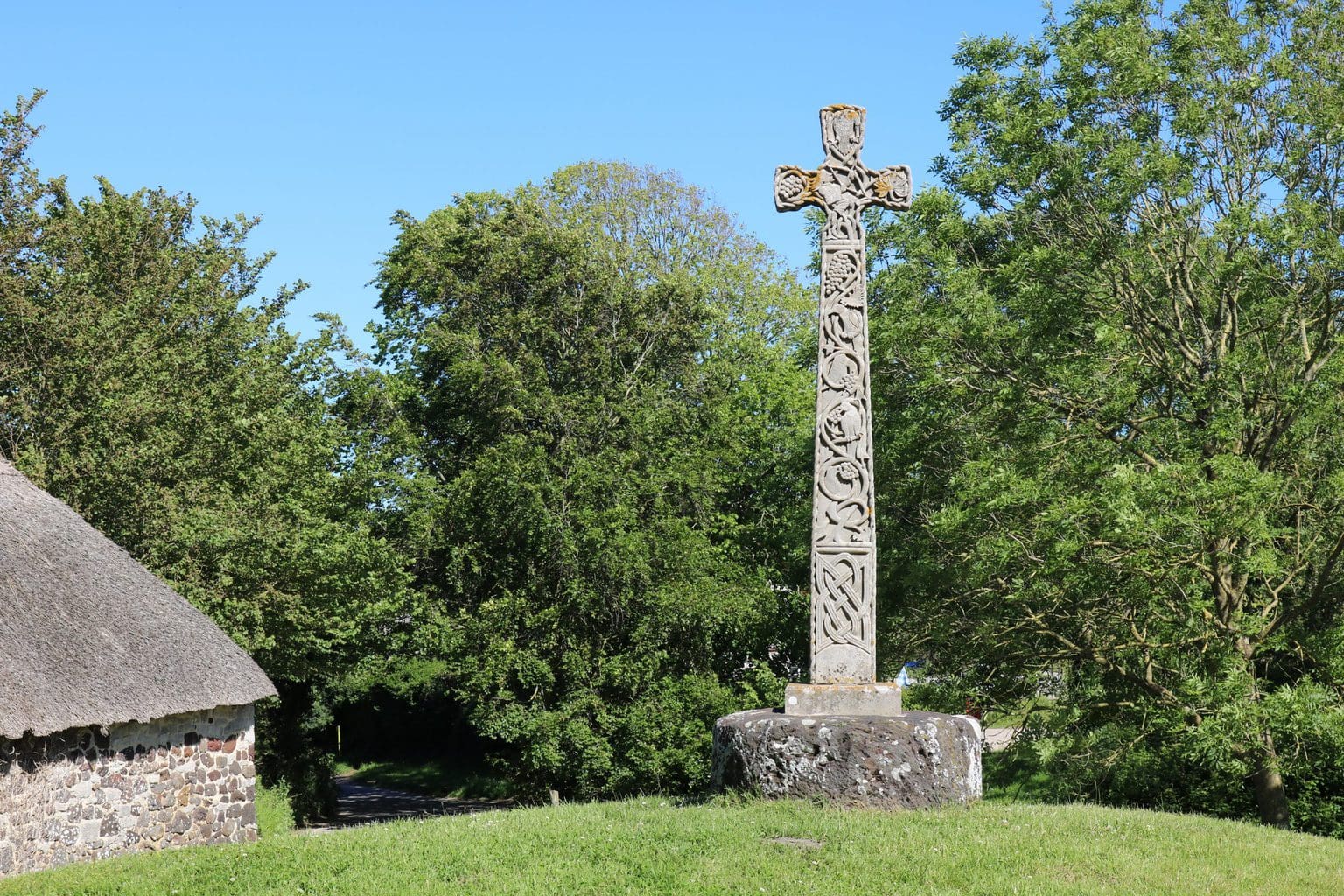
Keep straight on the road past any turnings until you reach the crossroads just past Manor Farm Tearooms. This is a great place to stop for a snack if you need it! There is an ornate stone cross on a small grassy knoll opposite – erected in 1975 on the site of an ancient cross.
Step 7 – Return via Studland Church (5 minutes)
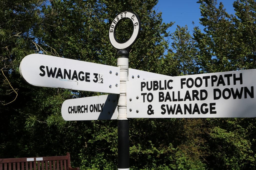
Go straight on at the crossroads, heading left and uphill. It’s quite confusing here so look out for the white-painted 4-way sign and follow the one for “church only “. It’s a short lane leading to a picturesque little church – worth exploring if you have time.
Pass through the little wooden gate and take the path to the left of the church. Immediately after the church, before the path leads into the churchyard, take the right turning to cut across the churchyard towards a metal kissing gate on the far side. There is a lovely memorial next to the gate for the men of the local parish who gave their lives in WWI.
Head through the kissing gate and follow the dirt track down to where it meets back up with the carpark.
If you need to avoid the kissing gate, you can turn right at the crossroads before the church and head down Watery Lane, which comes out just in front of the public toilets and the road to South Beach.
Refreshments and Relaxation
If you need refreshments before heading home, the Bankes Arms is a lovely pub with a fab beer garden for summer and roaring log fires during winter. Joe’s Cafe on the beach has some really great snacks, as well as local Purbeck ice cream! Also nearby is the famous PIG on the Beach for a fancy meal or a sumptuous afternoon tea in the gardens.
To cool off, head down to South Beach for a swim. The path down to the beach is just before the public toilets you passed at the start of the walk.
Wildlife on your Old Harry Rocks Walk
This Old Harry Rocks walk passes through several different areas, from coast to chalk grassland to leafy countryside. So keep your eyes peeled for the local flora and fauna.
The grasslands across the top of Old Harry Rocks and Ballard Down are known for their stunning array of wildflowers, especially in summer.
If you’re lucky, you can sometimes spot seals and pods of bottlenose dolphins in the sea around Old Harry Rocks!
You can also spot a vast array of seabirds, including greater black-backed gulls, which roost on the stacks at Old Harry Rocks. As well as seabirds, look out for peregrine falcons circling high above, particularly around Ballard Cliff and Ballard Down.
Download Printable PDF of this Route
If you prefer a paper route to follow, I’ve put together a FREE printable PDF of my Old Harry Rocks walk instructions. Click here to download.
I’ve taken out the detail and the optional extensions, so you might still find it easier loading this page on your phone to follow. If you’re worried about signal problems, save the page to a reader like the Pocket app so that you can still read it offline.

Thanks for sharing, we did a walk around Old Harry’s Rocks last year, it was rarer busy, hopefully I would go again when it’s less busy 🙂
Thanks for commenting! The Rocks themselves are often quite busy, especially on sunny summer days. Although I’ve never seen it crowded there, busy usually just means around 50 people!! Go early or later in the day if you want it a bit quieter 🙂 The walk itself, though, is generally very quiet. Most people walk as far as the rocks and stop, so the rest of the walk is blissfully quiet!
This was such a helpful blog – thank you. All the landmarks you mentioned really helped us stay on track particularly on the turn down the grassy path towards Glebeland Estate.
Thanks again!
Oh I’m so pleased! I’ve found some of the older guides to this walk are a bit vague and it’s hard to know if you’re in the right place! So glad to hear this helped. It’s a gorgeous walk isn’t it?
Thankyou for these very helpful directions, I found the route easily using the landmarks you described! What a beautiful walk!
Oh that’s brilliant, I’m so glad it was useful. It’s a beautiful part of the country isn’t it?! Thanks for commenting 🙂
My husband and I just used this route – your directions and the landmarks mentioned made it a really easy and lovely walk! Thank you.
I’m so happy it was helpful and glad you enjoyed the walk! It’s such a beautiful place 🙂
Just found your Old Harry Rocks walk notes after having done most of it in reverse while out geocaching today. The seat photo was useful as difficult to read now. I learnt (at school?) that Old Harry from legend was Harry Paye not Harry Payne as you quote. Is Payne a typo or do you have a different source?
Just a typo, thanks for spotting that – I’ve amended it 🙂 I took the photo of the bench earlier this year, is it even harder to read now?