Some posts on this site contain affiliate links. If you book or buy something through these links, I earn a small commission (at no extra cost to you). Take a look at my privacy policy for more information.
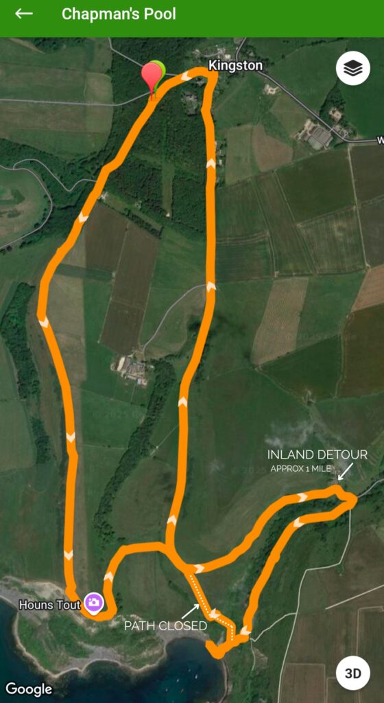
A circular walk from Kingston to Chapman’s Pool Beach via Encombe woods and Houns Tout.
Mostly easy (excepting a short, steep climb up and down to the beach), this circular walk from Kingston takes in woodland, valley, and clifftop paths.
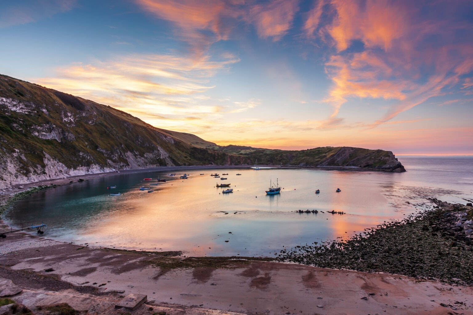
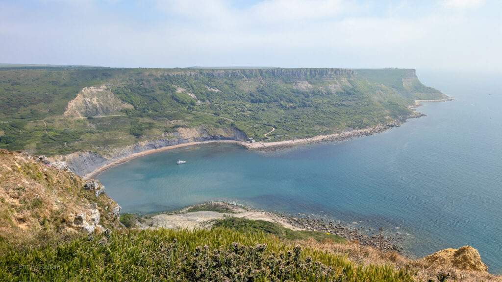
Enjoy exceptional coastal views (without the climb) from the top of the towering cliff known as Houns Tout, before meandering through the valleys to reach Chapman’s Pool. Only accessible on foot, this remote beach is a popular wild swimming spot – so pack your bathing gear if you fancy a dip.
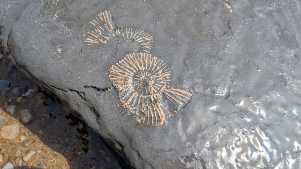
The beach is also known for its abundance of fossils, particularly ammonites, which can be seen in the rock shelves at low tide.
BE AWARE: There are no lifeguards on duty at Chapman’s Pool, so swim at your own risk. Also, the path leading down to the beach is steep and very uneven (and can be slippery when wet). Good walking shoes are advised. This walk is not advised for small children or those with limited mobility. See our shorter walk that skips the detour to the beach.
Details and Map
Distance: 6.2 Miles (including detour to beach, 1 mile each way)*
Time: 2 – 2.5 hours
Elevation Gain: 686 ft
Difficulty: Easy-Moderate
Accessibility: There are two sets of stairs and several stiles.
Terrain: Gravel, grass, dirt path, shingle beach.
Parking: Houns Tout Car Park, Kingston (free) – click here for location. There’s also limited road parking in Kingston Village, or you may park in the Scott Arms pub if you will be drinking/dining there after your walk.
*There is a shorter path that bypasses the 1-mile detour (as shown on my map below). However, it is closed off and no longer maintained, and is quite overgrown, so we do not recommend you take this path.
We have a shorter 3.5-mile walk which doesn’t include the detour to the beach. Click here for the route guide.
To make following this walk easier, feel free to use my GPS trail route on Wikiloc. It’s a free app where people can share hiking routes! You’ll probably still find my instructions below helpful, though.
Kingston to Chapman’s Pool 6.2-Mile Walk Route
Starting Point: Houns Tout Car Park, 28 West St, Kingston, BH20 5LL (click here for the Google Maps location)
Step 1: Walk through Encombe Woods
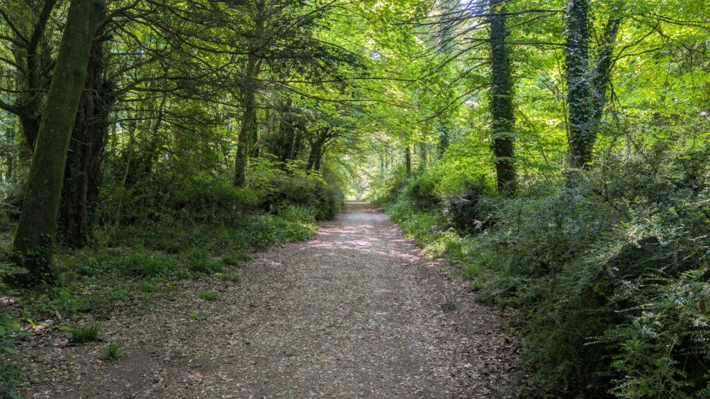
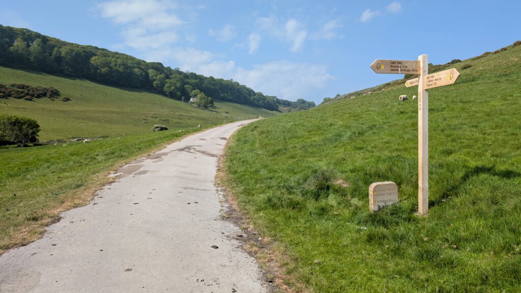
From the back of the carpark, take the footpath through the woodlands of the Encombe Estate (signposted for Houns Tout). The path runs gently uphill through the woodlands and is well signposted.
When this path reaches a junction (with a road visible to your right), take the left turn, ignoring the second left to continue south towards the Coast Path. (Shortly after the junction, a wooden signpost will confirm you’re on the right track).
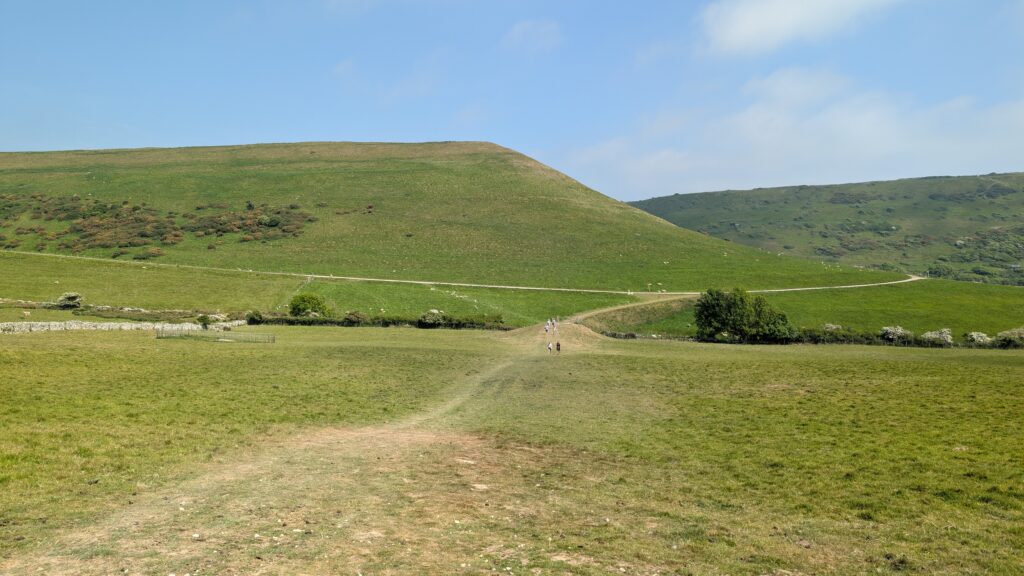
The path leaves the woods via a wooden gate and leads out onto the top of a grassy ridge. To your right is a stunning view of the wide valley, with Encombe House just visible between the trees at the bottom.
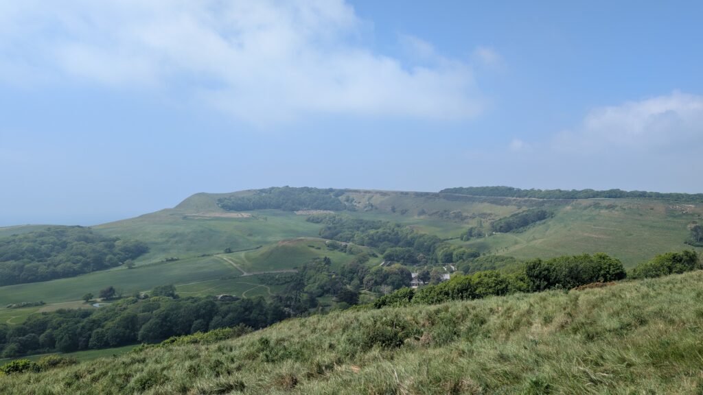
Follow the path along the top of the ridge as it curves slightly left (affording your first glimpse of the sea), then straightens out with the gentle climb towards Houns Tout ahead of you. Once you’re around that first left curve, you’ll have a better view of Encombe House in the valley to your right.
Step 2: Climb to Houns Tout
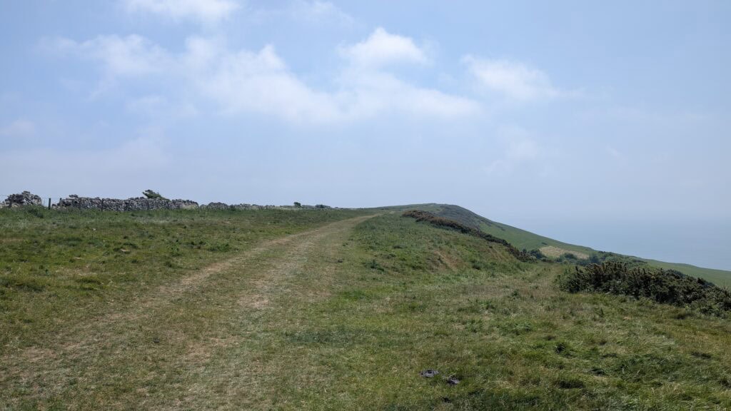
Stay on the ridge-top path (with a low dry stone wall to your left), passing through a wooden gate about halfway. Eventually, you’ll reach a wooden stile where the footpath connects with the South West Coast Path. Pause a moment here to enjoy the incredible views west towards Kimmeridge – look out for Clavell Tower on a low clifftop in the distance. On a clear day, you should be able to see Worbarrow Tout, near Tyneham (there’s another lovely walk here for another day).
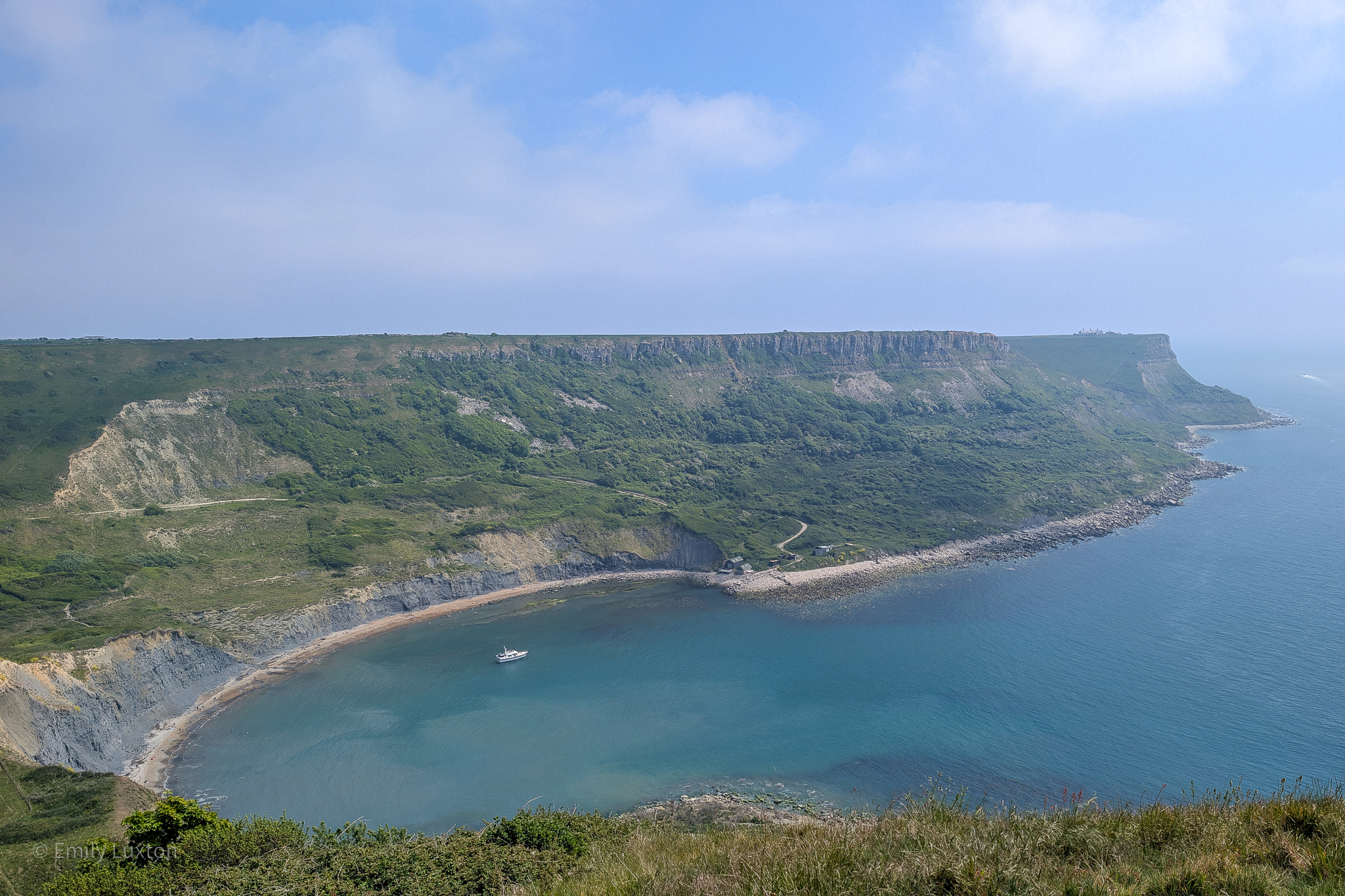
Turn left to follow the Coast Path as it curves around the edge of Houns Tout (with a sharp cliff edge to your right and a fenced-off field on your left). Looking ahead, you can see the impressive cliffs of St Aldhelm’s Head, topped with a tiny Norman chapel. After the path curves a little left, you will catch your first glimpse of the perfectly rounded cove of Chapman’s Pool below.
Step 3: Descend into the valley
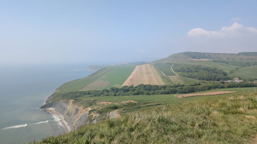
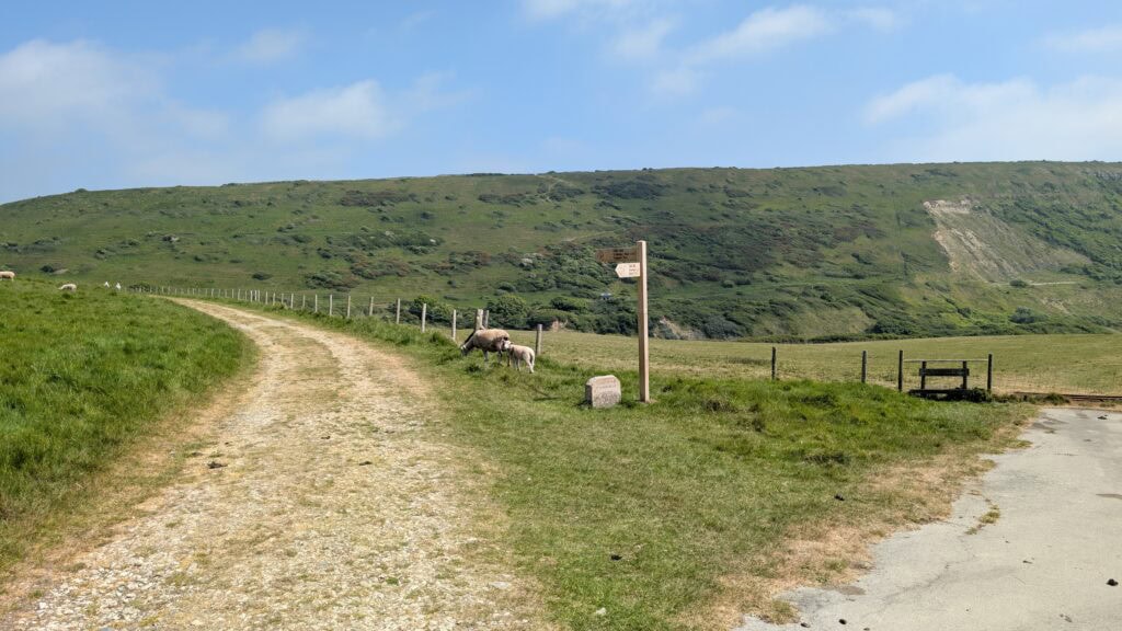
Follow the path all the way around the clifftop until you reach a wooden stile. Once over it, turn left to follow the coast path (the way is signposted for Chapman’s Pool). Head right before descending for another great view of Chapman’s Pool.
The gravel path descends sharply downhill until you reach a metal kissing gate. Again, follow the signpost for Chapman’s Pool, taking the well-worn grass path through the field across the bottom of the valley and over a wooden stile. Turn right when you connect with the tarmac path on the other side of the valley (again signposted).
Step 4: Inland detour to reach Chapman’s Pool Beach
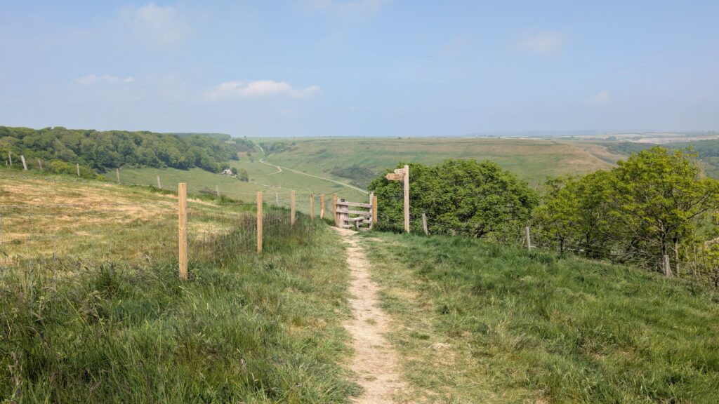
Where the tarmac path veers right into a field (see photo below), instead take the left fork to follow the gravel path (again signposted) around the bottom of a tall hill.
NOTE: There used to be a footpath here that led directly to the beach. Traces of it are still there, but there is a sign on the fence on the far side of the field advising that it’s closed. The path is quite overgrown and no longer maintained, so I advise you to follow the official route of the South West Coast Path: from this point, it’s roughly one mile to the beach.
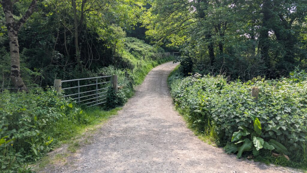
Here, the coast path leads away from Chapman’s Pool and inland along a river valley. Eventually, you’ll cross a stile, followed shortly by a second stile next to a metal gate, which comes out onto a lane by a cluster of cottages. Turn right onto the lane, then take the next right to cross a small stone bridge over a stream (photo below).
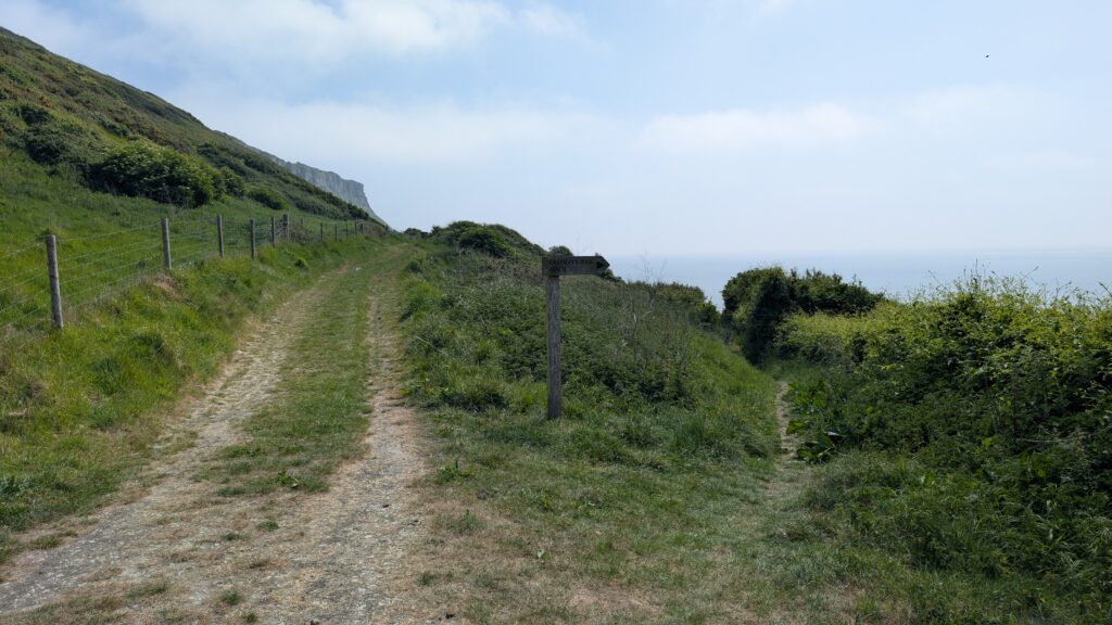
Just after passing through a metal gate, the path splits. The Coast Path heads left uphill to St Aldhelm’s Head; instead, take the right-hand fork forwards (signposted as a bridleway). Follow this back towards the coast until you reach a metal gate next to a disused stone hut.
Immediately after this, the path forks: take the narrow path on the right, signposted for Chapman’s Pool Beach (photo below). The path here is steep, uneven and can be very slippery, so take care. It winds downhill, eventually reaching the beach alongside a small waterfall.
Step 5: Return to Kingston
NOTE: Officially, the only way back is to retrace your steps until you reach the tarmac path from Step 3. Unofficially, there is still a trace of the old path leading across the stream and up across the field back to the main path, as seen in my map. However, this is no longer a maintained path and is very overgrown, plus the way at the top is fenced off. Therefore, I would advise you not to follow in my footsteps and instead take the long way back, by completing Step 4 in reverse.
Retrace your steps from Step 4 until you reach the tarmac path again. Follow the signpost for Kingston to take the path back into the valley you crossed in Step 3. The path loops gently back around the hillside and up into the valley.
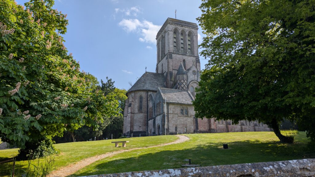
Stay on this path all the way back uphill, until you cross a wooden stile to connect onto South Street. This quiet country lane continues to slope gently uphill along the edge of the Encombe Estate woodlands. Follow it up to the village of Kingston, passing St James’s Church on your left – a pretty, Victorian church nicknamed “The Cathedral of Purbeck”.
Turn left onto West Street and follow it up through the small village to return to Houns Tout Car Park. If you’re in need of refreshments, the Scott Arms pub in Kingston Village has one of the best beer gardens in Dorset (if not the entire UK), with stunning views of Corfe Castle and the rolling Purbeck Hills.