
Some posts on this site contain affiliate links. If you book or buy something through these links, I earn a small commission (at no extra cost to you). Take a look at my privacy policy for more information.
This circular Dancing Ledge Walk from Durlston Country Park in Swanage takes you along the stunning Purbeck coastline to one of the area’s lesser-known attractions.
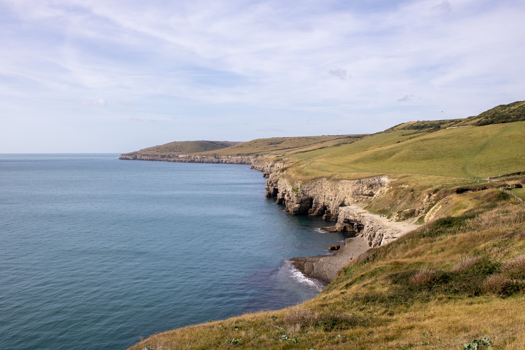
Spot dolphin pods off the coast, enjoy sweeping clifftop views, and explore the traces of this region’s historic limestone quarries as you make your way along the coast.
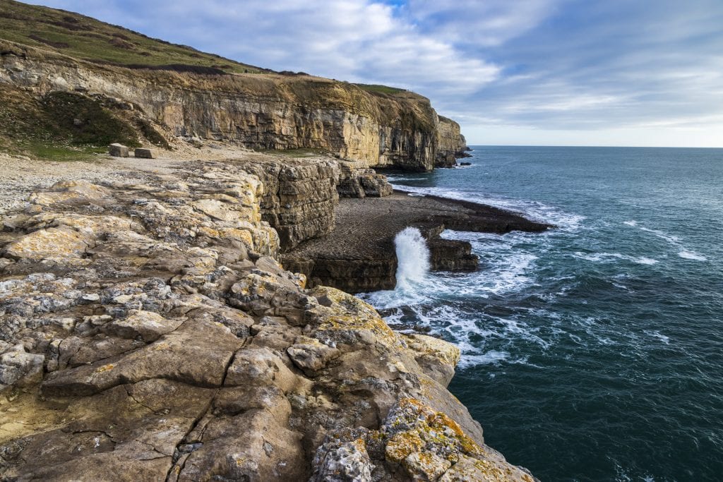
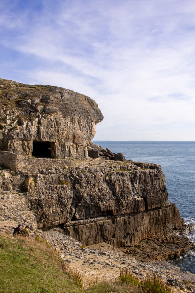
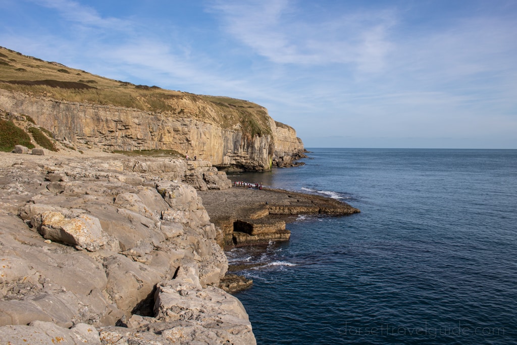
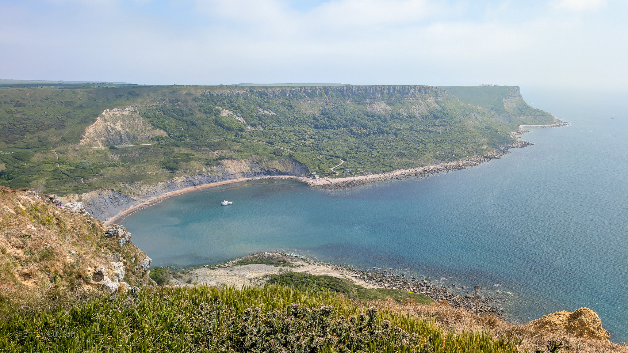
Dancing Ledge is a natural shelf of flat rock jutting out into the sea near the base of some cliffs on the Isle of Purbeck. It was once one of the many Purbeck limestone quarries dotted along this coastline, and a particularly useful one, as ships could come right up to the ledge to collect the stone.
The unusual name is thought to come from the way the waves seem to “dance” over the ledge at certain tides. Although some sources say it’s because the ledge is just the right size for a ballroom!
This walk to Dancing Ledge starts and ends at Durlston Country Park. An expansive nature reserve overlooking Swanage Bay, the country park is filled with wildflowers, butterflies, and other wildlife.
It’s also home to quite a few interesting attractions: a huge limestone globe, the old quarry at Tilly Whim Caves, Durlston Castle, and Anvil Point Lighthouse. You’ll pass all of these on the walk to Dancing Ledge…
ALTERNATIVE: 3.4 Mile Scratch Arse Ware and Dancing Ledge Circular
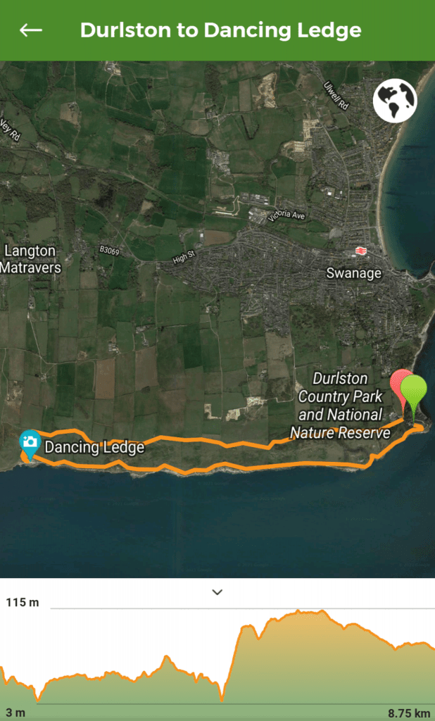
Dancing Ledge Walk – Details And Map
- Distance: 8.75km / 5.4 miles
- Time: 2 – 3 hours
- Elevation Gain: 198m
- Difficulty: Moderate
- Accessibility: Several sets of stairs, 4 stiles, and a few kissing gates. Some steep ascents and descents. Some very uneven ground and rocky sections.
- Terrain: Gravel paths, stone paths, grass, packed earth, and rocks.
- Parking: Paid parking at Durlston Country Park Car Park (BH19 2JL) – from £2 for 1 hour to £6 all day, card and cash accepted. There is some road parking on Durlston Road but this adds about 0.6 miles to your walk.
- Facilities: There are toilets, a cafe, and a visitor centre at Durlston Castle in the Country Park, as well as a free water bottle refill station. No facilities on the route or at Dancing Ledge.
NOTE: Take your swimming stuff if you’re walking this route on a nice day. There’s a small, manmade tidal pool on the ledge which is a great way to cool off!
To make following this walk easier, feel free to use my GPS trail route on Wikiloc. It’s a free app where people can share hiking routes! You’ll probably still find my instructions below helpful, though.
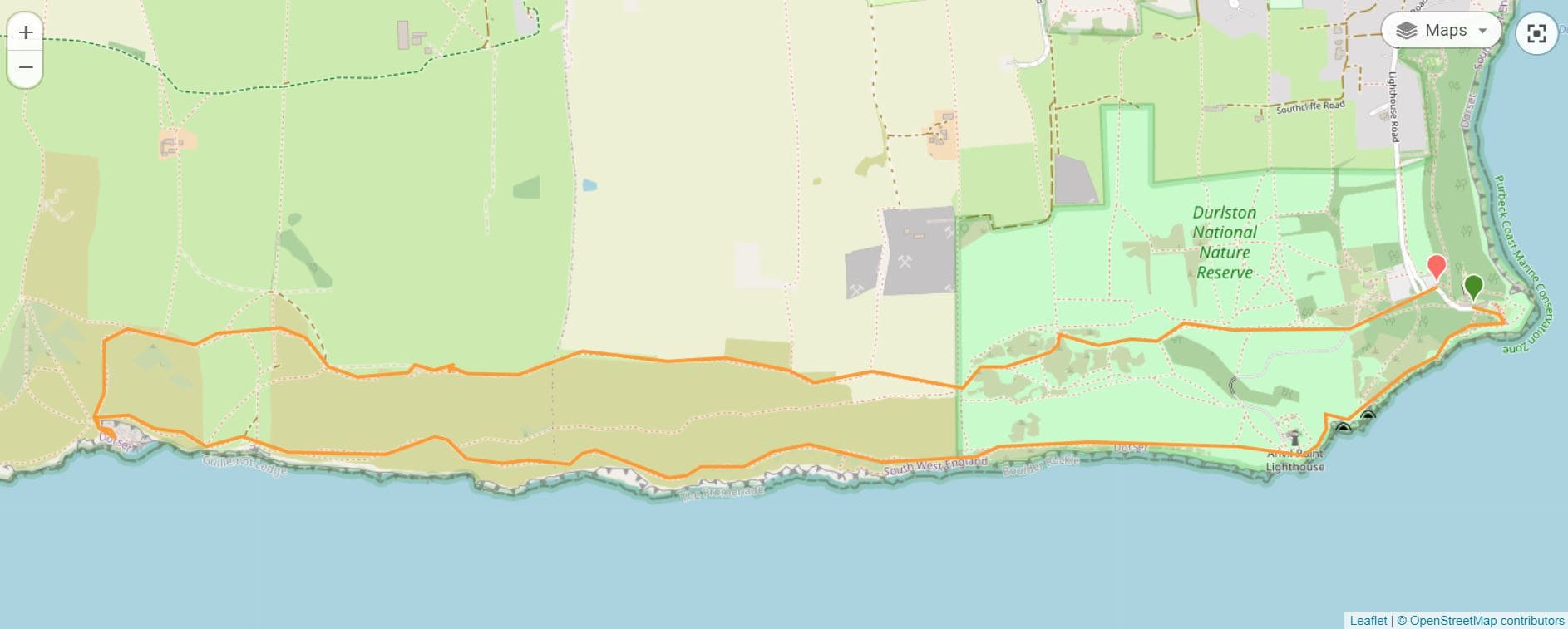
Dancing Ledge Circular Walk Route
Step 1 – Durlston Castle, The Globe, and Tilly Whim Caves
Starting Point: Durlston Castle Visitor Centre
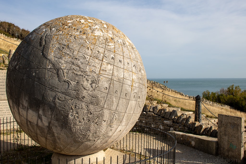
Setting out from the visitor centre at Durlston Castle, follow the path leading right of the castle signposted for The Great Globe.
Measuring 10 feet in diameter, this enormous globe was built in 1891 from 40 tons of local Portland limestone. Above the globe, Durlston Castle isn’t really a castle at all. It was built as a folly by local businessman George Burt, who purchased Durlston Estate for the limestone but also wanted to develop a tourist attraction as a way of giving back to the local townspeople.
Go down the stone steps in front of the globe and turn right onto the South West Coast Path. This leads slightly uphill to reach a viewing area with some stone benches and a glass partition. It’s not uncommon to see dolphins along this stretch of coast, so keep an eye on the water! Continue following the SW Coast Path (there is a sign for Dancing Ledge).
You will pass a bird hide on your right. Shortly afterwards, as you round the corner, you will be able to see Anvil Point Lighthouse up ahead of you.
Shortly before the lighthouse, you will pass the entrance to Tilly Whim Caves. These are manmade caves, leftover from an old quarry of the same name. The caves were once open to the public, but have been closed due to safety reasons – however you can get a good view of them from the path up to the lighthouse.
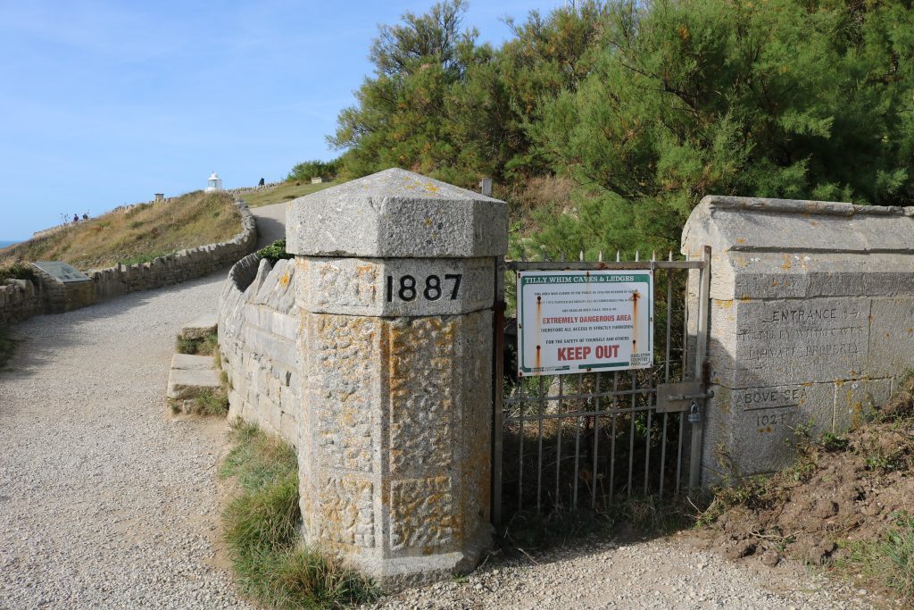
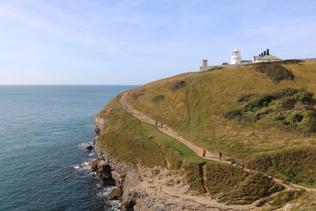
Continue following the SW Coast Path, passing through a wooden gate to walk towards Anvil Point Lighthouse. Before the lighthouse, the path zigzags steeply first down then back uphill via some steps and a very uneven rocky path. Take care here – especially if it’s been raining.
As you begin walking uphill, turn around to see the ledges and caves of the Tilly Whim quarry on the cliff behind you. Then keep walking uphill to go past the lighthouse on your right.
Step 2 – Anvil Point Lighthouse to Dancing Ledge
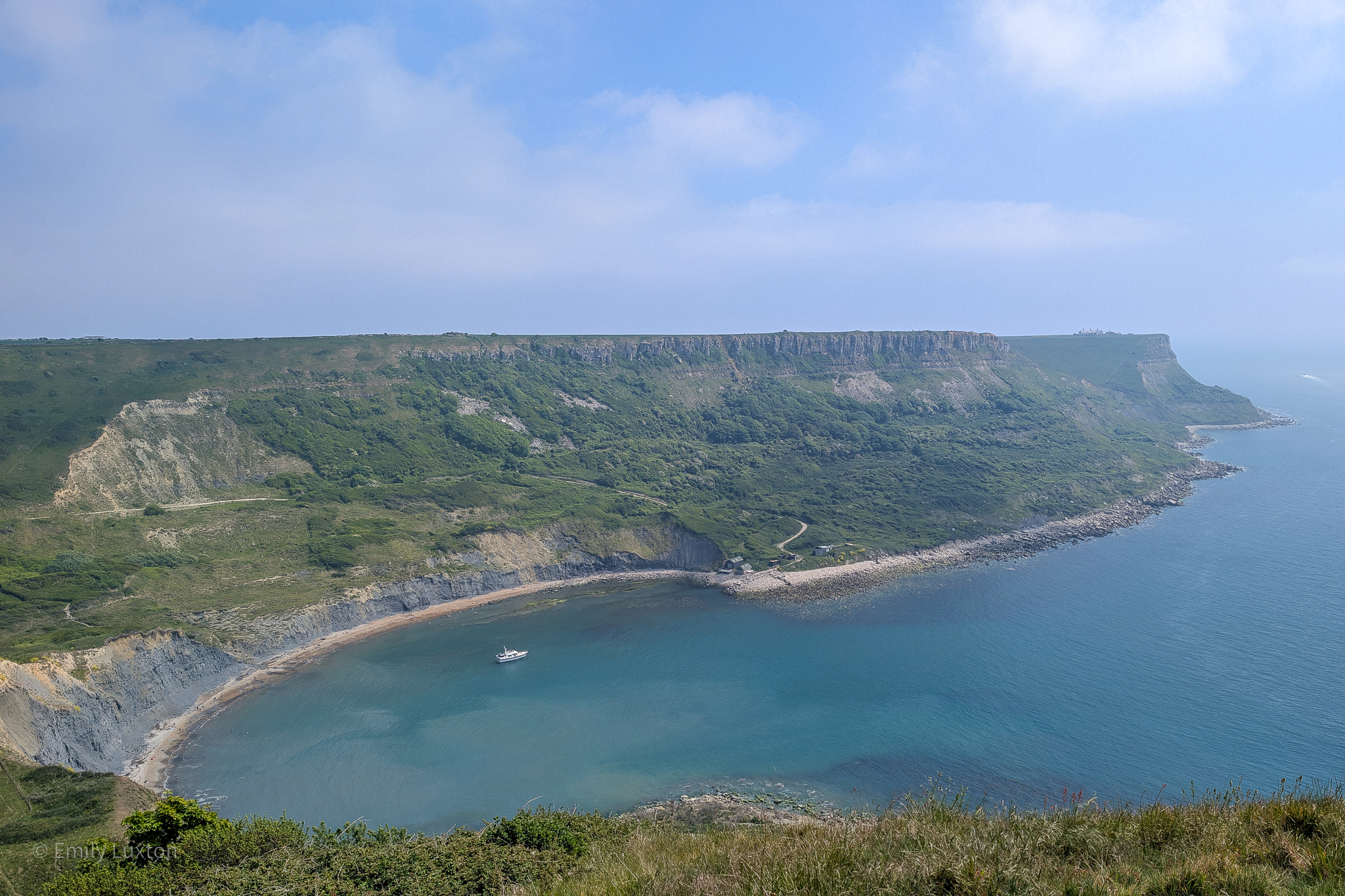
Just after the lighthouse, the rocky path turns to grass and a branch forks right to head uphill. Take the left branch which keeps closer to the cliff edge and follow the obvious grassy path forwards. The view ahead is of St Alban’s Head, the most southerly part of the Purbeck peninsula.
This entire section of the walk to Dancing Ledge really needs very few directions as the way is very obvious and there are no turn-offs. Simply remain on the SW Coast Path heading forwards for about 4km.
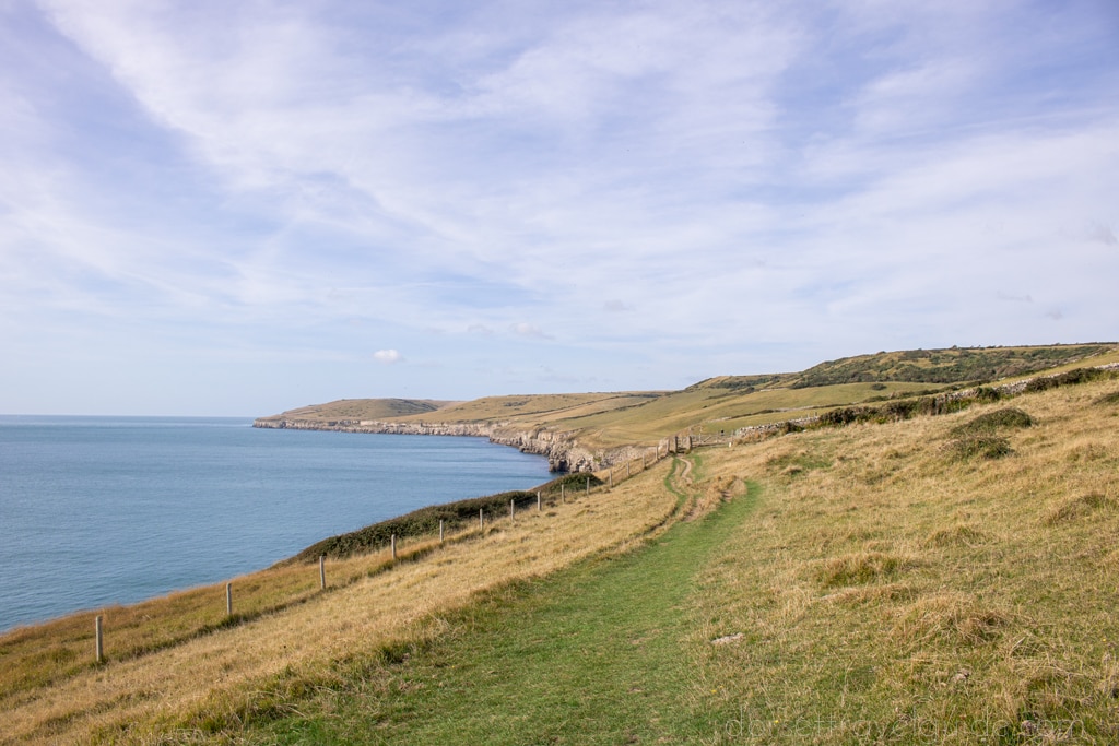
The path continues straight along the coast, passing occasional stone waymarkers for Dancing Ledge and going through a few gates. There are one or two points where the path appears to fork, however these are short temporary splits that rejoin each other very shortly afterwards.
About halfway to Dancing Ledge, you will pass to two metal structures that look like small pylons. These are mile indicator posts, set a nautical mile apart from the pair at Durlston. Passing ships can use the posts to measure their speed by timing how long it takes to travel between them.
Step 3 – Dancing Ledge
After passing through another wooden gate, the path descends steeply into a shallow valley and then climbs back out the other side. When you reach the wooden gate at the top of this, you will have an excellent view of Dancing Ledge ahead of you.
Continue along the path until you reach the stone wall just above Dancing Ledge, with a stile on your left. Cross over this and head down the stone steps to the ledge itself. Spend some time exploring the old quarry and enjoying the views. Be careful of the sheer drops and uneven ground, especially if you’re visiting with children.
This area makes an excellent place for a picnic (but please take all your rubbish home with you). In nice weather, it’s also a popular wild swimming spot. The sea itself is a bit dangerous, but there is a small tidal pool down on the ledge. This was blasted out of the rocky shelf by quarrymen in the early 1900s for local school children to learn to swim.
Step 4 – Upper Path to Durlston
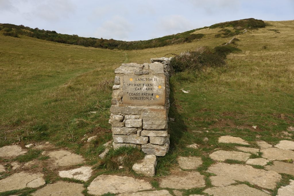
When you are done in the quarry, take the same stone steps back up to the stile at the top. With your back to the stile, take the path leading diagonally uphill to the right of the stone wall. It is signposted “Spyway Barn Car Park” and marked by wooden National Trust markers.
The wide, grass path leads almost straight uphill, then curves to the right to join the public footpath at the top of the hill. Follow this back in the direction of Durlston with the sea on your right.
After passing through the first wooden gate shortly after reaching the top of the hill, the path will fork. Take the lower righthand path and follow it downhill then uphill through a gap in a stone wall.
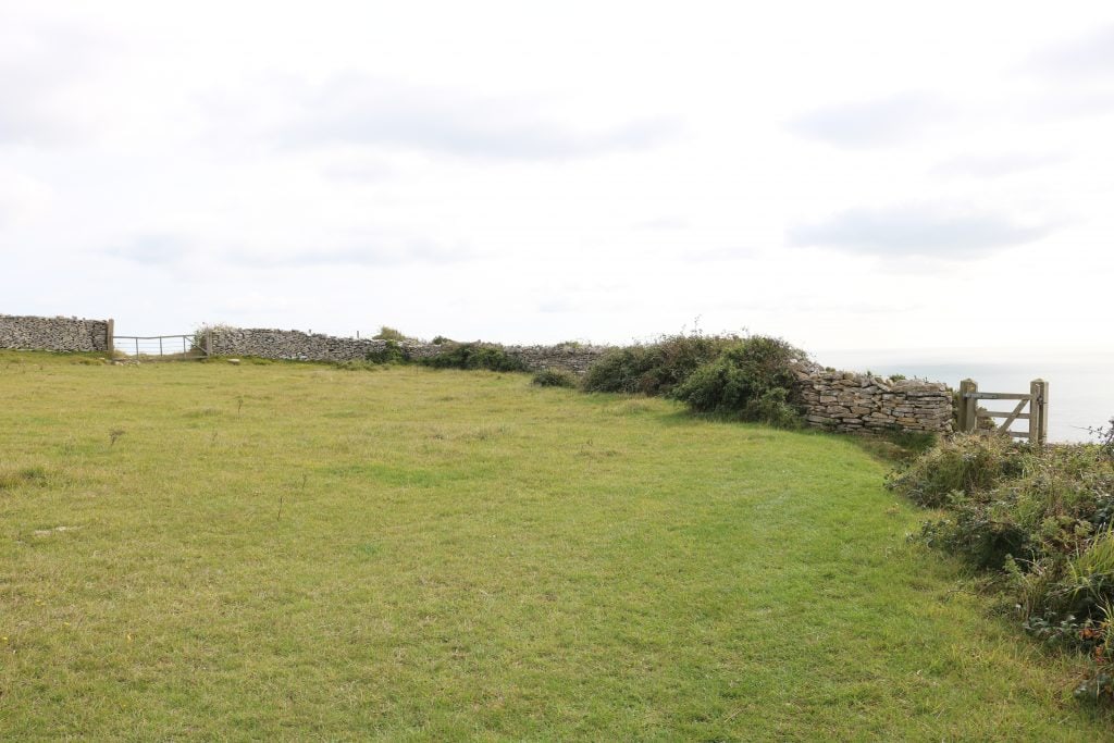
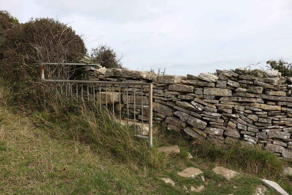
Keep following the path slightly uphill, until you reach another stone wall with a wide gate ahead of you. On your right just before this wall is a small wooden gate (photo below) with a yellow public footpath marker: go through this and follow the path along the ridge with the stone wall on your left.
Alternative Route Up:
There is another route up which is less steep but can be a little trickier to find as it zig-zags across the fields a little. This path was still clear as of 11/10/2021:
From Dancing Ledge go back along the SW Coast Path the way you came until you reach the gate from the start of step 3. Through this, look for a stone marker on your left pointing out the “Upper Path to Durlston”, which breaks away from the coast path to veer diagonally upwards across the field. Follow it uphill and through an obvious gap in the stone wall, then bear left slightly through the second field to go through a clear gap in a hedgerow. Finally, bear right through the third field to find a gap in a stone wall with a public footpath marker, where you will join the Upper Path.
Step 5 – Upper Path to Durlston
As with the walk to Dancing Ledge, the way back to Durlston is very simple and requires few directions. Stay on the footpath along the top of the ridge, keeping the stone wall on your left and the sea on your right.
Just before the mile indicator posts from step 2, you will go through a wooden gate, and shortly after you’ll cross a stile beside a wide gate. From this point, there is a superb view of the Isle of Wight across the sea ahead. A little later you’ll come to another stone wall barring your way: a metal fence highlights the stone stile here, with a stepping stone on either side of the wall.
Step 6 – Durlston Country Park
After passing through a gap in yet another stone wall, you’ll see a stone waymarker showing 1 mile to Durlston. Ignore the path leading away to the left here and continue following the main public footpath forwards and slightly right towards a wooden kissing gate ahead of you.
Just after this gate the path forks, with yellow public footpath signs pointing left and right. Both paths lead back to Durlston Castle so it’s up to you. The lefthand path veers away from the coastal views and gives you a better chance to explore the wildlife of the nature reserve, especially during spring/summer when the area is rich with wildflowers and butterflies. The righthand path takes you close behind Anvil Point Lighthouse.
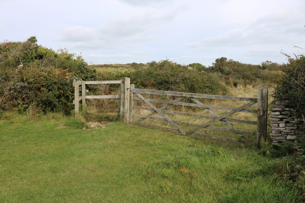
If following the lefthand path, it will lead across the reserve and through a patch of hedgerows, where it will turn sharply left. Pass through the kissing gate on your right here (photo below) to keep moving east in the direction of Durlston.
Stay on the grassy path, passing through a wide wooden gate with a stone stile next to it, after which you will have a lovely view down to the lighthouse on your right.
Head through the next wooden kissing gate, marked with a red Herston Trail marker, and keep heading forwards until you join the Lighthouse Access Road. Go left through the wooden gate and follow the road back to the carpark at Durlston Castle.
The visitor centre in the Castle is worth a visit if you have time. They hold regular exhibitions in the gallery space and there is a lovely cafe if you’re in need of refuelling!
Read More
15 Short Dorset Coast Walks Under 4 Miles
The Ultimate Isle of Purbeck Travel Guide
If you enjoyed this Dancing Ledge walk, or have any feedback for me, please leave a comment below! Especially if any info needs updating.

Did the walk today in windy but mild weather. We followed the instructions and opted for the ‘easier’ climb up. Ha!!! The path didn’t exist, we had to scrabble through bracken, gorse and brambles!!! We eventually got to the high path and loved the walk. We had lunch at the castle cafe, even got tea and cake at 4 . We would do it again but maybe not rely on this website.
Hi Sue – so sorry you had trouble finding the easier path. I actually did the walk on the 11th October and I promise you the easier path was there then, and I didn’t have to go through any gorse or brambles. I think because it’s just a grassy track zigzagging across the fields it might not be easy to spot exactly where you have to go – it’s a less steep climb but a bit harder to spot. I’m going to change the wording of my description to clarify that.
While I was researching this post I did two walks in one day and walked up the alternative path on my second walk, you can see the GPS map of the route here which shows exactly where the path up is: https://www.wikiloc.com/hiking-trails/dancing-ledge-and-scratch-arse-ware-86122603
Thank you for commenting, I’m hoping your feedback will help me make the post clearer for the next people who try it!
Brilliant description of the walk! We have a terrible sense of direction and this saved us getting lost! Many thanks!!
Oh great so glad it helped! I tried to be really detailed as I know how easy it is to get lost!!