
Some posts on this site contain affiliate links. If you book or buy something through these links, I earn a small commission (at no extra cost to you). Take a look at my privacy policy for more information.
This circular Golden Cap walk from Seatown takes you up to the highest point on the South Coast of England, returning via an inland route past a ruined church packed with history and through the lovely woodland on Langdon Hill.
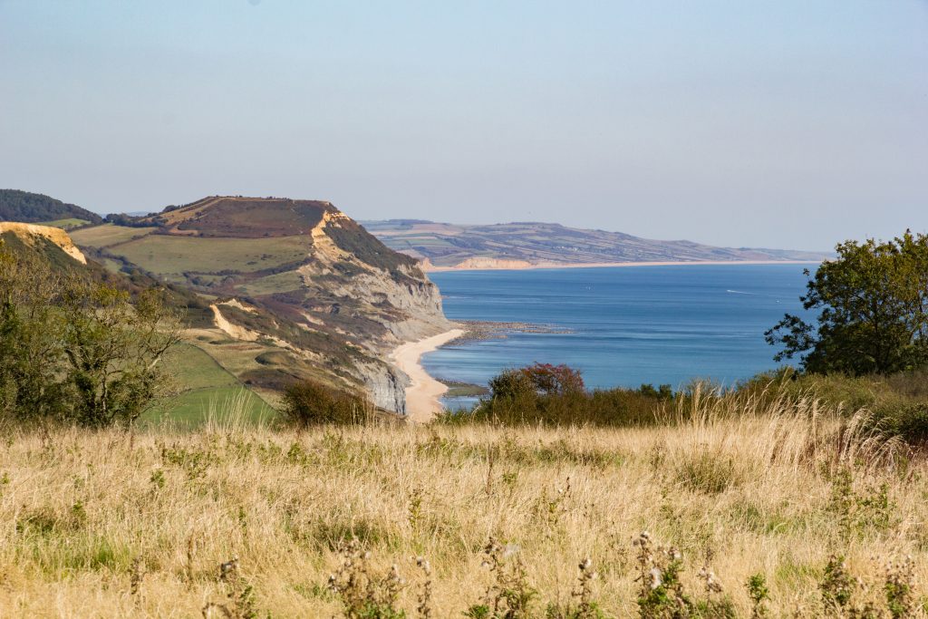
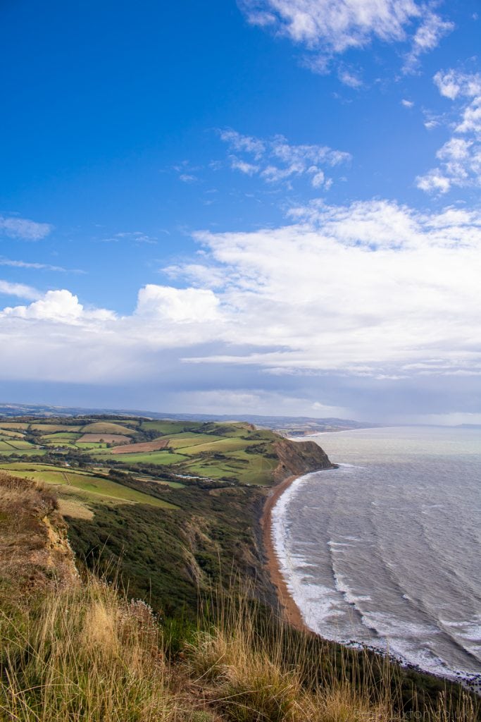
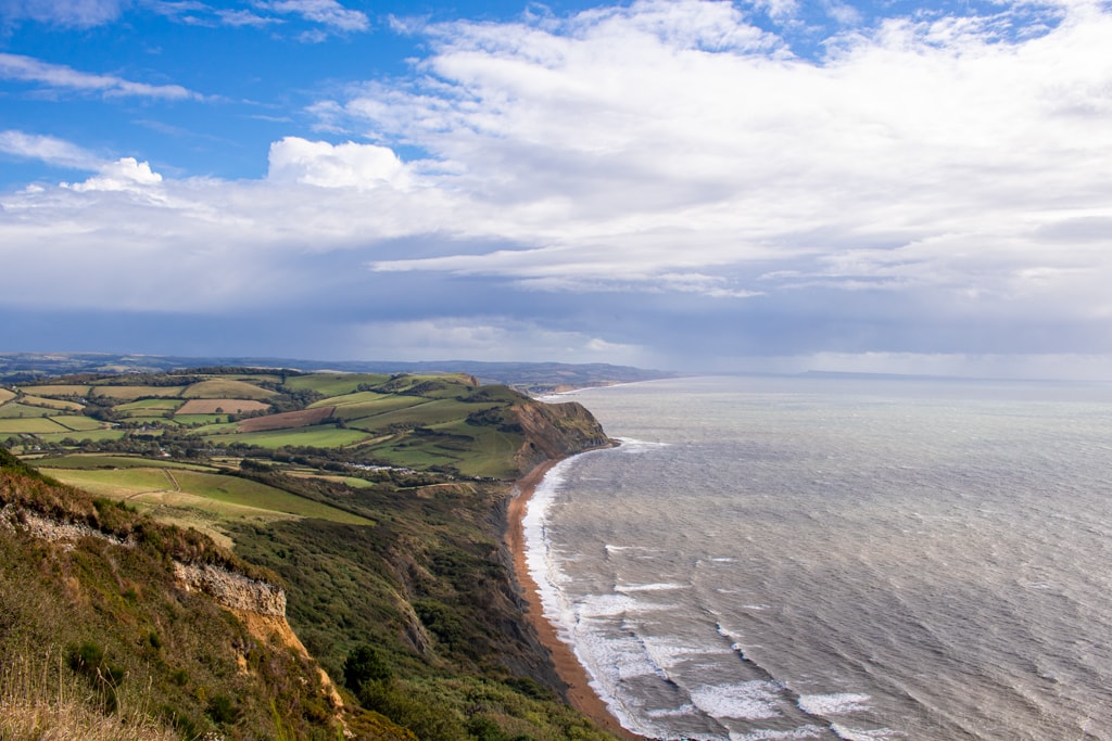
At 191m (627ft), Golden Cap is the highest point on the south coast. The climb to the top is quite tough, with some very steep sections, but the views along Dorset’s Jurassic Coastline are well worth it!
The Golden Cap lies on a large National Trust estate filled with farmland, meadows, woodland, and the “lost” village of Stanton St Gabriel. This abandoned hamlet was originally a Saxon settlement, and was mentioned in the Domesday book in 1086! Today, all that remains are the ruins of a 13th-century chapel.
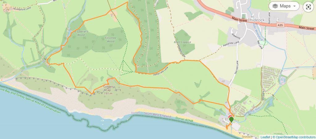
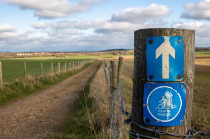
This 4-mile circular Golden Cap walk explores much of the estate, including the old chapel. Following the South West Coast Path for the first section, most of the trail is signposted, clear, and easy to follow. But the rest of the walk can be trickier, so this local’s guide should help! Enjoy…
Golden Cap Walk – Details And Map
- Distance: 6.5km / 4 miles
- Time: 1.5 – 2.5 hours
- Elevation Gain: 299m
- Difficulty: Challenging
- Accessibility: Several sets of stairs which cannot be avoided. No styles, several kissing gates. Steep ascent and descent up and down Golden Cap, with a moderate ascent and descent on the return route inland.
- Terrain: gravel paths, dirt tracks, grass, and steps. Part of the walk follows a country road with no pavement.
- Parking: Paid parking at Seatown Carpark (DT6 6JU) – £5 per car, card and cash accepted. There is no road parking nearby so the car park is your best bet.
- Facilities: None on route. There are toilets, a pub, a shop and a small beach cafe in Seatown.

To make following this walk easier, feel free to use my GPS trail route on Wikiloc. It’s a free app where people can share hiking routes! You’ll probably still find my instructions below helpful, though.
Golden Cap Circular Walk Route
Step 1 – Seatown to Golden Cap
Starting Point: Seatown Car Park, DT6 6JU
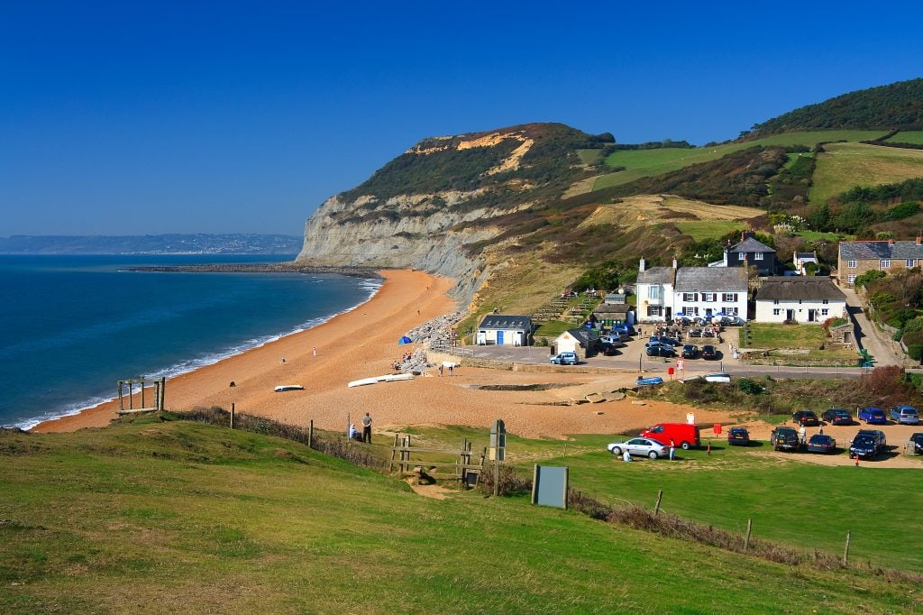
Cross the small wooden footbridge leading out of the car park and turn right onto the road. Follow Sea Hill Lane towards Chideock, following the South West Coast Path diversion signs. Take care on this road as it’s a single track country lane with no pavements.
Just after the holiday park, you’ll see a low stone wall on your left, with a gate and a signpost for Golden Cap. Turn left here.
Follow the SW Coast Path over a small wooden footbridge and across the field, with the sloping form of Golden Cap ahead of you. Pass through a kissing gate and cross another footbridge to walk through the copse. Head through two more gates and onto the steps. Time to start climbing!
Step 2 – Walk up Golden Cap
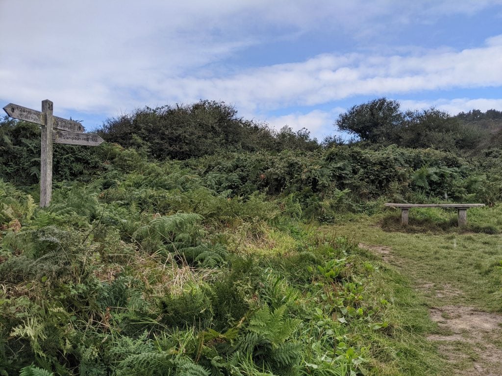
The trail is clear (and steep!), leading straight forwards until you reach a wooden bench next to a fingerpost. Although the sign for Golden Cap is pointing straight ahead, the path actually veers left past the bench. The narrow, slightly overgrown track to the right of the bench leads to Langdon Hill.
Shortly after the bench, you’ll go through another gate to emerge into an open field. The way up Golden Cap is clear before you, so follow the grass path straight across the field, through another kissing gate, and begin your ascent proper.
The walk up Golden Cap is very steep, so take your time and stop whenever you need. At the first wooden bench you reach, turn around to enjoy the views back down to Seatown. You’ve already come a long way!
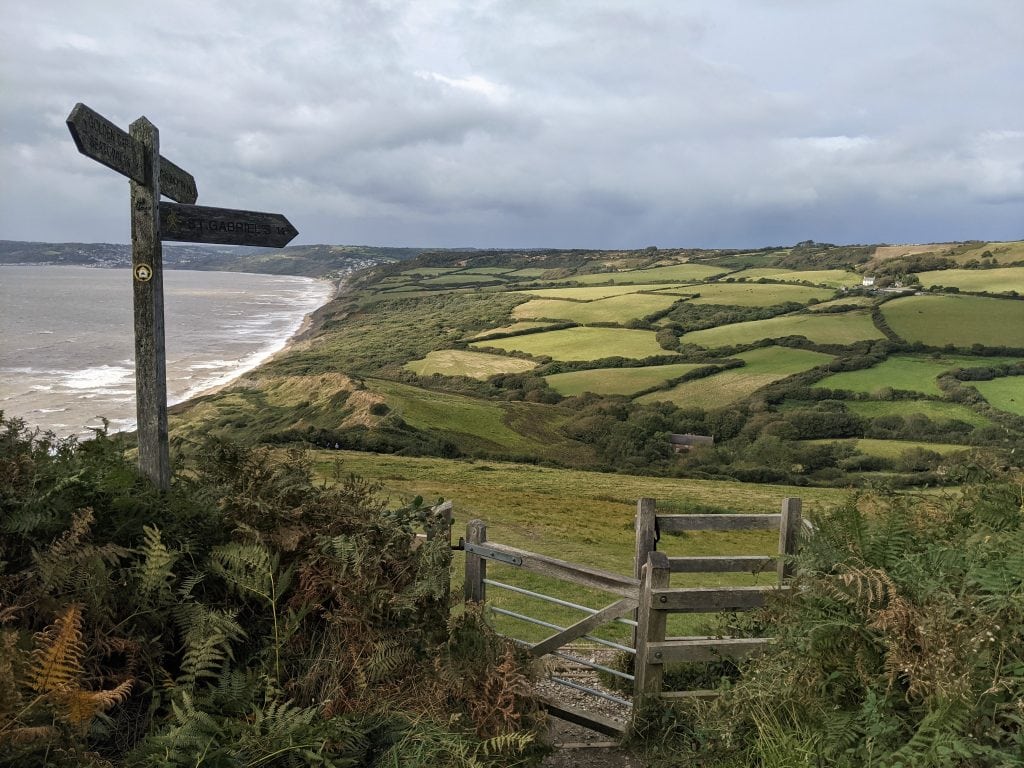
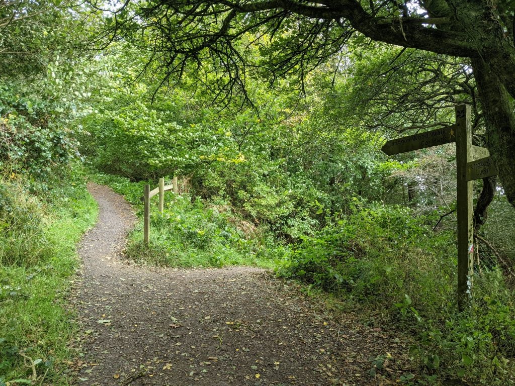
You’ll pass through another gate and emerge onto the back of the hill, with a view to the northeast towards Colmers Hill near Bridport. You’ll come to a fingerpost where the coast path meets the track from Langdon Hill (photo below). Follow the coast path sign through another gate and up some steps which will curve around to reach the top of the hill.
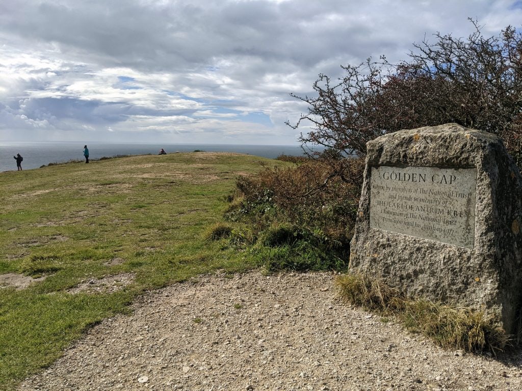
There is a stone waymarker here, but this isn’t quite the peak. Follow either of the two paths leading forwards until you reach the stone sign that says Golden Cap.
Step 3 – Descend Golden Cap
Stop for a while on top of Golden Cap to enjoy the views in both directions, down to Seatown behind you and ahead towards Charmouth and Lyme Regis.
Optional: If you want a shorter walk, begin by heading back down the way you came until you reach the fingerpost at the bottom of the steps. From here, take the signposted trail back towards Langdon Hill, and skip ahead to the kissing gate at Step 6.
When you’re ready to press on, follow the SW Coast Path (there is a small stone trail marker) as it zig-zags down the other side of the hill via a long steep staircase.
When you come to a wooden gate, the SW Coast Path carries on straight towards Charmouth ahead of you. However, for the Golden Cap circular walk, head diagonally right across the field following the signpost for St Gabriel’s. Take care as it is a steep descent.
Step 4 – St Gabriel’s Chapel
At the bottom of this field, follow the signpost left through the hedgerow to find the ruins of St Gabriel’s Chapel.
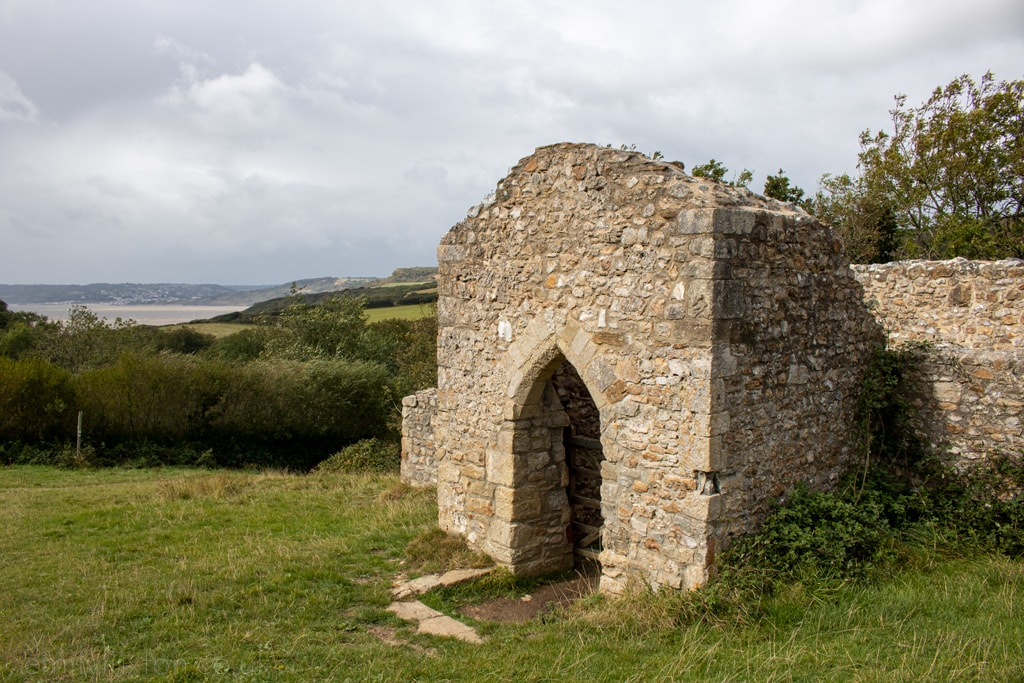
The chapel was part of Stanton St Gabriel, a small hamlet which was abandoned two centuries ago. Most of the building dates back to the 13th century, while the porch was built in the 14th century. It’s said that smugglers used the ruins to hide contraband. According to local legend, the chapel has a romantic history:
“Two newly weds, escaping from a storm stricken ship in a small boat, came ashore here. The husband prayed to St Gabriel for their salvation and promised to build a chapel if they were saved. Despite his wife dying in his arms on the beach, he was as good as his word.”
Golden Cap Team of Churches
Follow the path through a large wooden gate, then past a red brick farmhouse on your left. This historic property has been converted into four holiday cottages, managed by the National Trust.
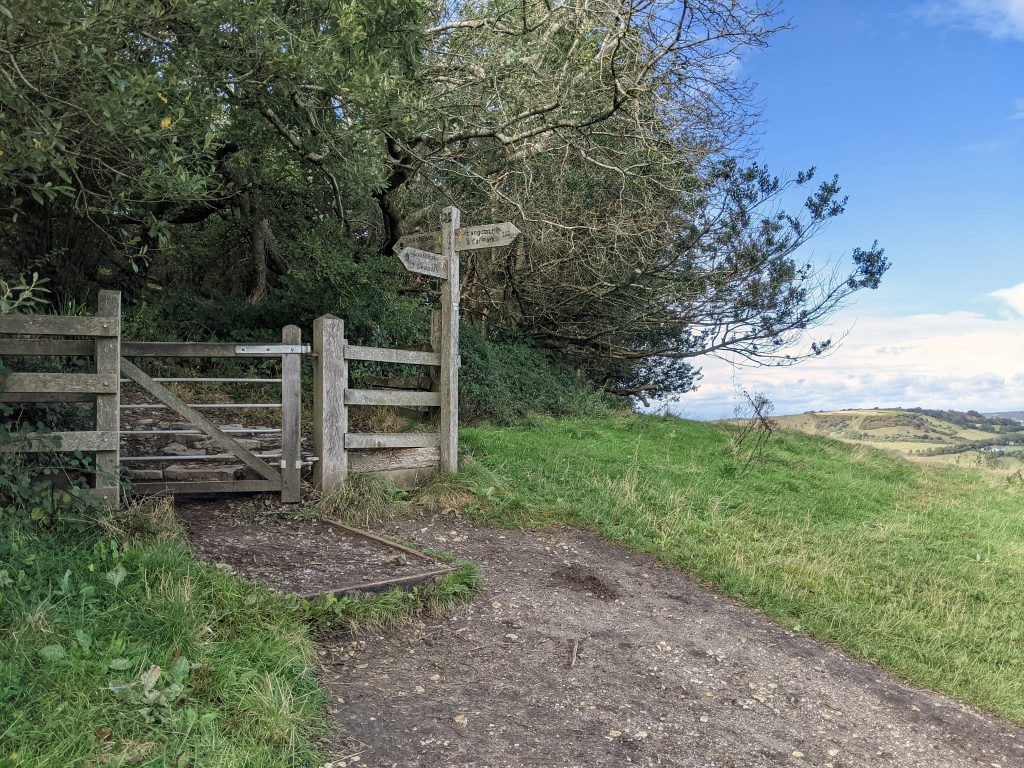
With the cottages behind you, follow the track out and then immediately take the gate on your right (photo below), signposted for Langdon Hill Car Park.
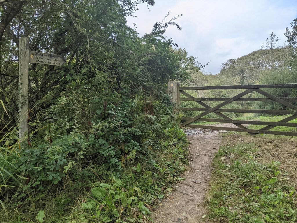
Follow the dirt stone path until you reach another wide wooden gate leading into St Gabriel’s Wood. At the next wooden gate, where a left turn points towards Morecombelake, continue straight following the Langdon Hill Car Park signs through the woodland.
Step 5 – St Gabriel’s Wood to Langdon Hill
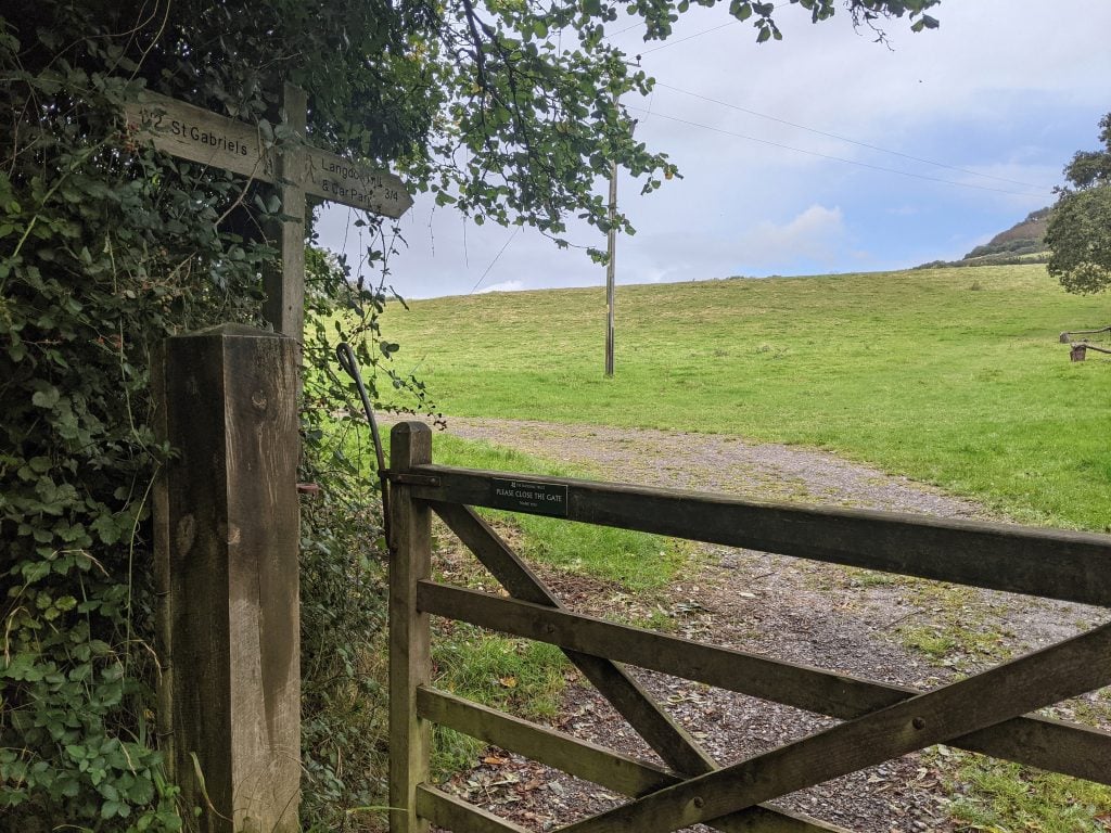
When you emerge from the woods via a wide wooden gate, the track curves to the left but the signpost points forward (photo above). Follow this and head forwards directly up the hill along the edge of the field, through a hedgerow, and along the edge of the second field, where you will see a large wooden gate and a fingerpost in the top right-hand corner.
This emerges to the left of Filcombe Farm. Cross the lane and head through another wooden gate to climb uphill along the edge of another field towards Langdon Hill woods.
Once you reach the edge of the woods there are two options. Heading left will loop you around the top of the woods and back down the other side to reach Seatown. My preference is to go right and follow the track gently downhill along the edge of the woods.
Step 6 – Langdon Hill to Seatown
After the path curves left around the bottom of the woods you will reach a fork. Take the right-hand path (signposted Golden Cap) and head downhill a short way until you reach a wooden kissing gate.
Turn left here, following the sign for Seatown. It’s a narrow dirt track between tall ferns, with the sea on your right and the woods on your left. Keep straight on this path, following signs for Seatown and ignoring any turnoffs. Take care if it’s been raining as the path can become quite muddy.
Eventually, the path widens out. Ignore the overgrown lefthand path at the fork (marked as Petticrate Lane on maps), and continue forwards along the wide, obvious track between tall hedgerows, with a view of the tall cliffs east of Seatown ahead of you, until you reach Sea Hill Lane.
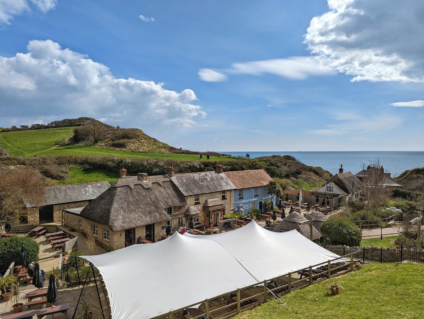
Turn right onto the road, taking care of traffic as there are no pavements, and follow it back down through Seatown to the Carpark. There is a pub and an ice cream shop here if you’re in need of a well-earned reward. I’ve not personally tried The Anchor Inn yet, but I can confirm that the locally made ice creams and cakes from Baboo Gelato are very good!
Download a Printable PDF Of the Golden Cap Walk
If you prefer a paper route to follow, I’ve put together a FREE printable PDF of my Golden Cap walk instructions. Click here to download.
I’ve taken out the detail and the optional parts, so you might still find it easier loading this page on your phone to follow. If you’re worried about signal problems, save the page to a reader like the Pocket app so that you can still read it offline.
Read More
15 Short Dorset Coast Walks Under 4 Miles
19 Fun Things to do in Bridport (and West Bay) in Dorset
If you enjoyed this Golden Cap walk, or have any feedback for me, please leave a comment below! Especially if any info needs updating.
According to our Strava it was more like 5 miles and took a bit longer than we expected, about 3 hours. That said the directions were inch perfect and we enjoyed a beautiful walk.
Oh really? Perhaps Strava is more accurate than what I use – my GPS tracker had the walk down at 4.2 miles (and that included a little bit of doubling back to check signs and details as I was taking notes). Interesting that it came out at 5 miles for you! I did it in 2 hours 15 with a fair few stops, was moving for about 1.5 hours, but I’m always a bit wary giving timings as everyone moves at different speeds!
So glad you enjoyed the walk, though! It’s a beautiful spot!
We walked this route on on 9 September 2022. Really easy directions to follow with great views and some of it away from the beaten track. Liked the information and potted history provided. Some of the guides we’ve used have been far from straightforward , but this one is great
Oh that’s so great to hear! I’ve been really frustrated with the walking guides I’ve used in the past, so decided I would create my own!! Great to hear you found this one useful – Golden Cap is a really beautiful spot, isn’t it?
Brilliant walk and excellent directions. Thank you.
Thanks so much Maureen – it’s a beautiful spot isn’t it?
Hi Emily
We followed your guide notes for the Golden Cap circular walk today, a great walk in beautiful surroundings. The detail in your guidance was absolutely spot on in all aspects.
Thank you
Hi Dave, thanks so much for commenting. I’m really pleased you found the guide helpful! I’ve been meaning to go check everything is still the same so it’s good to know you didn’t have any issues following the guide 🙂
Thanks 🙂